• About
  • Photographs
    • In Praise of Agiofili Beach
    • Corfu’s Most Beautiful Village?
    • Making a splash in Vassiliki

Andy James

~ A Writers Journey

Andy James

Category Archives: Dolpo trek

Outward leg 2 – Pokhara

02 Wednesday Nov 2016

Posted by andyjameswriter in Dolpo trek

≈ Leave a comment

This morning we left Kathmandu for Pokhara. We were due to leave our various overnight lodgings at about 9am although this being Nepal matters didn’t go entirely to plan.

We were aware there were to be major road closures, most noticeably the one we would take to the airport, due to an event involving the visit of a senior foreign dignitary. We had been advised the closures would start from 10am, hence our planned departure at 9am.

At about 7:30 we received a call from our agent (aka most excellent fixer) saying he understood there had been a change of plan and the roads would be closed at 9am and if we didn’t leave very soon we would be stuck.

At this time following remarkably calm consideration a 3 point plan was put into action.

1. One of the team put a call though to the British Embassy security team to ask the truth of the matter. He would call back with an update as soon as he had investigated and the phone was to be manned.

2. A runner beat a hasty path to the local swimming pool to retrieve the person who was to drive us out of the compound. (We could have walked of course but she insisted as she wanted to see us off).

3. The escapees were alerted to put aside their toast and to be ready to walk to the airport should the driver not be found in time.

In no time at all, although regrettably not before the bedraggled driver had been pulled from the water, the inestimable security team called to advise there was indeed a change of plan. The roads were to be closed at midday. Hardly believing their ears and trying not to chuckle the recipient of the m phone call asked for confirmation that the roads would be closed until midday. No came the response, they were to be closed FROM midday. Panic over – breakfast resumed!

The moral of the story? In Nepal expect the unexpected and avoid early morning swimming if you’re on driving duty.

Perhaps due to the impending closures or maybe due to the bustling presence of our agent smarting from having been misinformed, the airport appeared less busy than usual. The departures hall had been smartened up. Gone was its hangar-like appearance with massive queues, every piece of baggage weighed on dubious machines and the onward passage of apparently overweight luggage often assisted by, ahem, palm grease, and every item carried from sight by hand. In the place of those gates of torture were a row of smart travelator-linked check-in desks manned by uniformed staff each of which bore the name of a local airline: Tara, Buddha and others including the airline with which we were booked ‘Yeti’. The Yeti corporate logo was proudly displayed: ‘You come first’. And we did. Things were definitely looking up.

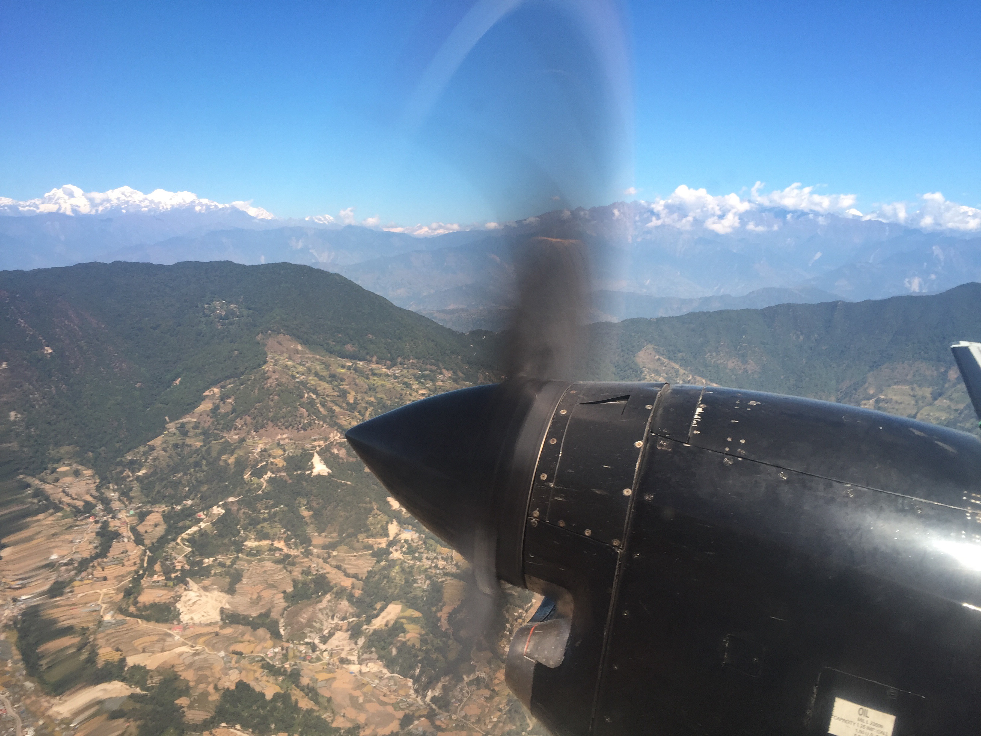
While waiting to board I was delighted to see my bags loaded into the small hold on the Jetstream 41 which was shortly to whisk us to Pokhara. This British Aerospace plane held 29 passengers in a small but adequate cabin with one column of single seats on the right and pairs of seats on the left. Tim and I were happy, as you can see, to grab a pair on the left.

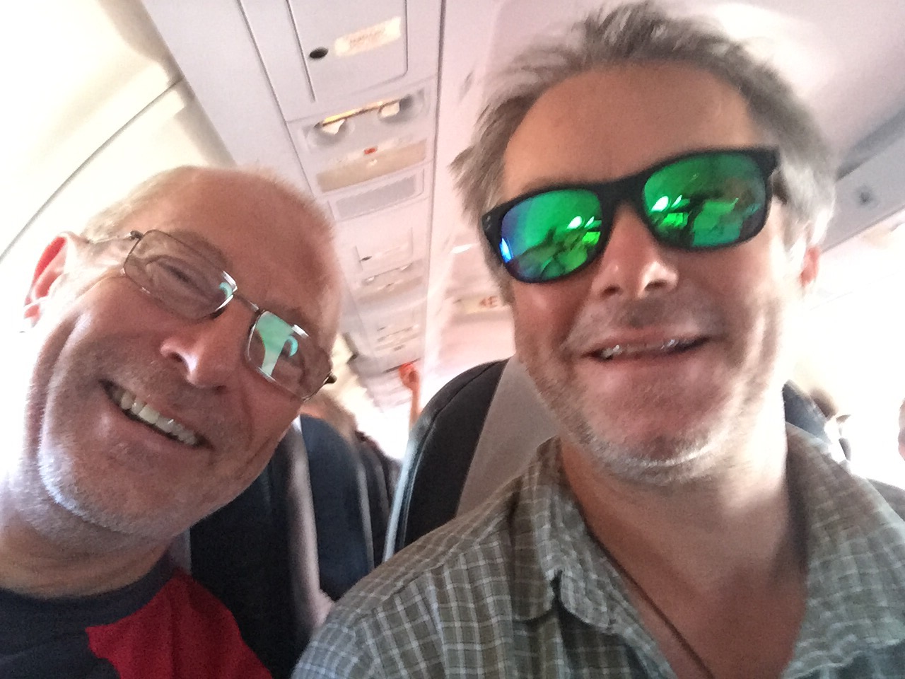
If the proximity of the propellor could be ignored seats on the right got the best views of the mountains to the north as we flew west.

The flight was just 40 minutes yet the appropriately diminutive and impeccably attired stewardess handed us a boiled sweet and a snack of some peanuts bearing a different Yeti logo ‘we fly with you’. It must have been at the back.

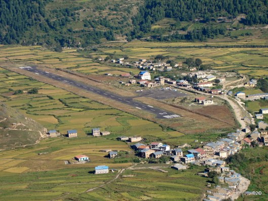
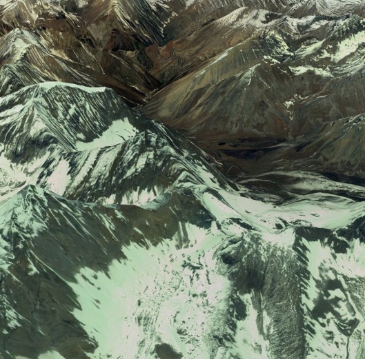
The airport serving Nepal’s second city turned out to be a gem. Small, personable, and, for an airport, beautiful with a mountain backdrop.

Our bags were produced in no time and around 10 mins after landing we were on our way in 2 cabs to the hotel on the outskirts of the city. Happily ensconced in the last nice room for over 3 weeks it was nonetheless necessary to head to a supermarket for last minute essentials such as dried apricots, dioralyte, wet wipes and trekking essentials before taking lunch at a delightful little restaurant beside the gorgeous Fewa Lake.


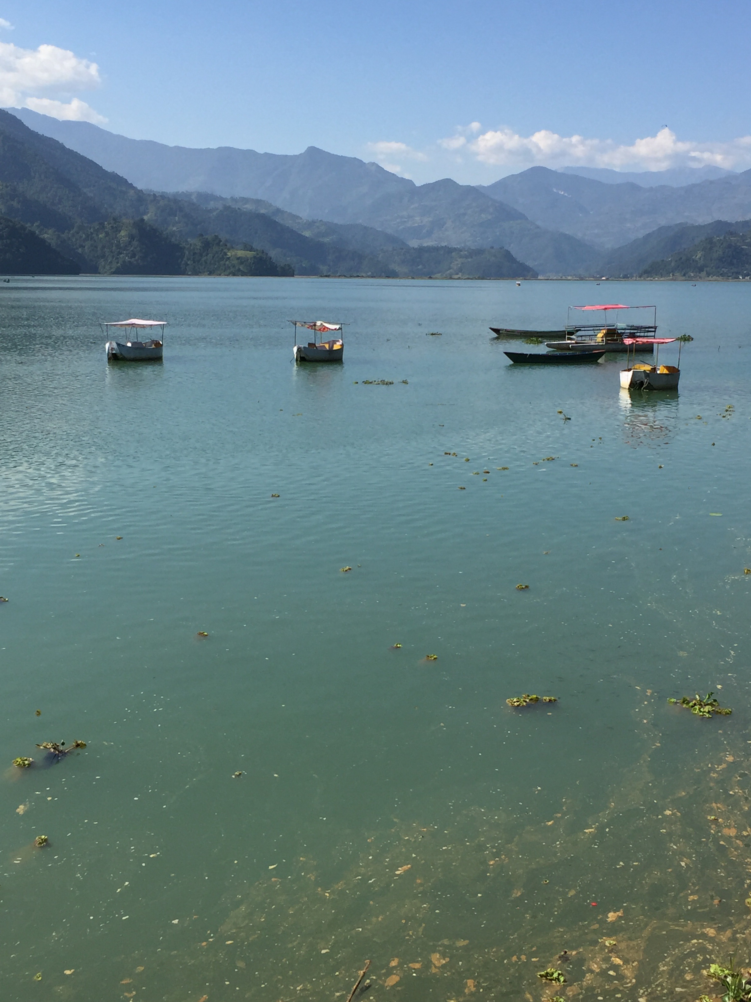
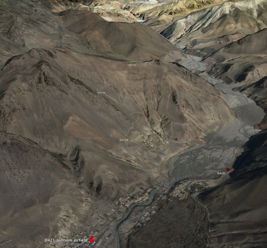
There is really nothing more I can tell you to compare with this stunning view from our sunny lakeside table. Not posh. Not expensive. Just perfect. An easy time eh? Yes, but it all changes tomorrow when we are on the early (pre-breakfast) flight to Jomsom.

Outward leg 1 – to Kathmandu

02 Wednesday Nov 2016

Posted by andyjameswriter in Dolpo trek

≈ 6 Comments

My flight from London to Delhi was mostly uneventful. Mostly. About 2 hours after take off there was a short fight between 2 passengers a few rows behind me on the other side of the plane. This event, the cause of which I never learnt, was calmed and settled by the team of unflappable air stewards and stewardesses. This was followed by a nervous couple in front of me fainting. They ended up laying on the floor by one of the over-wing exits surrounded by the same team of unflappable air stewards and stewardesses, one of whom ‘paged’ for the assistance of a doctor. One duly appeared and the situation was resolved much to the delight of the rest of the passengers who could again task the ‘unflappables’ with the apparently more important business of serving food; in my case a rather tasty chicken curry.

The remainder of the flight was much less interesting although the views from my window seat throughout the starry night was a beautiful procession of streetlight-illuminated towns. By the time the sun came up we were over Asia and the desert of southern Afghanistan and south of Kandahar appeared straight from ‘Laurence of Arabia’.

After crossing Pakistan the flight was subsequently stacked in the customary circuit 100 miles west of Delhi awaiting air traffic clearance to land, which we eventually did 45 minutes late. This delay caused some concern as that gave me just over an hour to make the flight to Kathmandu. The transit was mercifully rapid with a reduced degree of administrative checking, searching and scanning of my hand luggage. With 15 mins to spare and feeling quite relieved I arrived at gate 14B at Indira Gandhi International to find the flight had been delayed 2 hours! Never mind, we were able to claim lunch at the ‘Connections’ restaurant – my second chicken curry of the day.

Remarkably the delay didn’t get any worse and we took off for Kathmandu at 15:45. With the view from my window seat slowly morphing from the grey fug of Delhi to the brilliant blue sky and distant view of pristine white mountains a late lunch was served. Yep, chicken curry.

I had prepared for my arrival at Kathmandu’s Tribhuvan International airport by reviewing immigration and taxi procedures online. This had served only to bring on a degree of trepidation with tales of woe from previous travellers. These typically related to administrative overkill, scrums and mayhem in baggage reclaim and vulture-like flocks of taxi drivers preying on the unwary. I needn’t have been concerned. Transit through immigration was aided by the recent installation of online registration terminals in addition to the old fashioned manned desks. The only issue here was that following endless minutes spent typing details of my current and previous trips to Nepal the machine flatly refused to obey my request to take my photograph. Repeated and increasingly vigorous stabs of the ‘take my photo’ button resulted only in increased muttering from queue building behind me. Eventually an American chap stepped forward offers by to try pressing the button while I arranged myself in front of the camera. Piqued that he thought I needed help I nonetheless gratefully accepted without any expectation of success. Flash! He had a magic touch lacking in my own digit and I moved on to the next queue. Having paid for my visa I then joined another to actually collect it and then it was through to the next hurdle: baggage reclaim.

The baggage conveyor stopped and started in characteristic fashion with every bag and package that emerged being pounced upon by several members of the 3-deep crowd of hopefuls surrounding the chute. Joining them would have been fruitless so I stood back watching in equal measure the emerging bags and those being claimed. After around 30 minutes my dark blue ‘Jagged Globe’ duffel appeared unmolested. Stage 2 had been completed.

Stage 3 was to get a cab. Unexpectedly there was no queue at the pre-paid taxi counter. I paid my R700 (700 Nepalese Rupees – around £5:50) and was shown to my car. Large, clean with plenty of room I was whisked into the Kathmandu evening to meet Tim at the British Embassy where we were to spend the night. Not in a cell but in the home of one of our fellow trekkers who has accommodation in the compound.

A quick shower later we were on our way to Kilroys for a meal where the team of 5 met for the first time and the chat and laughter bodes very well! Fish and chips was the food choice this time as I’d had enough chicken curry for one day. Following a beer or 2 at Sam’s afterwards to progress the process of bonding stumps were drawn on the day.

And what a day!

Tomorrow we move to Pokhara.

Time to go – at fever pitch!

31 Monday Oct 2016

Posted by andyjameswriter in Dolpo trek

≈ Leave a comment

All systems are go now. It’s around 6:40 Monday 31st October and I’m at the airport. London Heathrow T4 of course. Excitement is not the word. It’s at fever pitch. We take off at 8:50 pm local bound for Delhi, then after a change of planes I head for Kathmandu. But the journey started nearly 3 years ago as a dream, then became a dashed plan last year and now it’s real. It hardly seems possible.

I have calmed down the training in the past 2 weeks so as not to sprain, pull or otherwise damage anything. I’ve also increased food intake to hit my target weight of 13 stones, achieved today. The training was replaced with packing, weighing, re-packing and re-weighing, I think 5 times as I strove to get the right balance between essentials and weight.

I think it’s right now. The duffel is 22kg but that includes my exped sack, and quite a weight of various supplements including multivitamins, amino acids, complex B vitamins, omega 7, magnesium, rehydration salts etc. I think this is essential to be able to maintain reasonable health when we will be short of food and burning several thousand calories each day while struggling with altitude and the inevitable sickness. As a result some things I thought to be important had to be left behind. My trainers for example. They were to be comfortable camp footwear but I’ll make do with my boots and sandals if my toes need a break. I have also packed just one solar charging unit. The remaining one had better be good otherwise the satphone and GPS units will die.

I have minimal spare clothing. I have basically taken 2 of everything in thin and thick to cope with the heat of the day and bitter cold at night. We are expecting temperature swings from around 25°C during the day to -5°C at night. Thus a fairly high proportion of my carried weight will be my Rab summit 900 4-season sleeping bag and liner and my trusty ME Annapurna duvet jacket for the night, and lots of sun screen for the day.

As ‘luxuries’ I have Peter Matthiessen’s ‘The Snow Leopard’ to read and some delicious tablet made by Clare and some Kendal Mint Cake from my brother Richard. All have to be carried of course but we’ll be out there for 3 weeks and need a little something extra to keep spirits up if the flesh is struggling.

Anyway, enough of the prep. Three of the others on the trek are in Kathmandu now and Tim arrives about now. I’ll be last to arrive about 15:00 local (10:15 U.K. time) tomorrow. It will then be a mad scramble to the shops to buy a tent and a Nepal Telecom SIM card so I can keep the blog going and then to a bar, probably Sam’s Bar, to meet the others. That will be when the fun starts.

To be honest, right now I’m feeling quite nervous. This is the first time I’ve embarked on a ‘self-planned’ expedition rather than booking with an established company. Of course I trust Tim and am confident in my route planning, preparation and fitness, but nonetheless this trek is still a ‘first’. It has never been done before. It is a real adventure.

Bring it on! The next blog will be from the mad and wonderful Kathmandu.

Many thanks to everyone who has helped me get this far. This adventure would not be possible without your help, support, and encouragement.

Into the ‘home straight’

26 Wednesday Oct 2016

Posted by andyjameswriter in Dolpo trek

≈ 2 Comments

Well it would be except we’re not yet even close to home and the way will be anything but straight!

Days 17 onwards will see us trek from Takla Khola via Tajachaur to Gamgadhi on the Great Himalaya Trail High Route before heading south on a lesser tail to the airfield at Jumla. Said quickly that sounds very reasonable but in this final 5-day section of the trek we will cover 80 miles; 40 miles over 3 day on the GHT High Route to Gamgadhi and another 40 miles over 2 days heading south to Jumla. Those last 2 days had better be downhill!

On the first day, scheduled to be 19th November but that will depend on progress, we will cross our final significant pass, the 5150m Chyargo La before heading down the Chham Khola to the camp site at Thajachaur (4050m). At about 9 miles this won’t have been our longest day but the pass is still among the highest so we won’t be jogging. The picture below, inevitably from the amazing Google Earth, shows what the ground might look like from the pass and the route as it snakes down the valley.

Tour_Guide_and_Google_Earth.jpg

On day 18 we continue heading along the river and progressively downwards. After Shilenchaura Kharka at just under 3000m we pick up the main river in the area, the Mugu Nadi, and follow it to Tiyar. As it is broadly downhill all the way we should be able to cover a fair distance and are planning on 18 miles. We will also have a reduction in height of over 500m to 2418m as we approach the village of Tiyar which sits at a major river junction.

Tour_Guide_and_Google_Earth.jpg

On day 19 we will follow the Mugu Karnali Nadi along its well populated valley to Gamgadhi. While not visible on the photograph above, there are many villages of varying sizes on this stretch and we should have no issue finding food, and possibly lodgings as a welcome alternative to camping as the novely of the latter may have worn off several days previously. As can be seen in the photograph of Gamgadhi (below) this is a significant settlement in which we should find resupply facilities. While Wikipedia offers no population figures it does report a community FM radio station, Radio Mugu, on 107.4 MHz. It really does. Here is its web address: www.radiomugu.com.np

Rara_Lake,_Nepal_11.JPG

From Gamgadhi we head south away from the High Route and while still 40 miles and 2 long hard days away Jumla will now be feeling closer. We will spend the night of day 20 at the village of Nauri Ghat before continuing on what should be our final day, day 21, to Jumla and its airport which will doubtless look like an oasis.

41630993.jpg

Whether we will arrive in time to fly out that day or not we shall see. I wouldn’t expect that we would, so the evening will be spent in welcome relaxation before returning to Kathmandu 2 days hence via a stopover at Nepalgung. There are no direct flights to Kathmandu from remote Jumla. At this stage we just hope to make it this far and will worry about getting back to Kathmandu later.

I hope very much to share our journey, which starts in earnest a week tomorrow, with you. Thank you for reading the preparatory blogs which will complete over the weekend with an insight into trek clothing and equipment.


Onto the roller coaster!

23 Sunday Oct 2016

Posted by andyjameswriter in Dolpo trek

≈ Leave a comment

The next 5 days (days 12 to 16) see us heading into what looks from Google Earth and the map to be a 40 mile long roller coaster of high passes and river valleys, the Kholas. Following the toughness of the first 5 days as we rapidly gained height out of Jomsom, the second quarter of our trek was predominantly through high-sided valleys. That will end dramatically after Saldang. The picture below hopefully gives you the gist of the terrain. The high points are no fewer than 4 passes of over 5000m, including the highest of the whole trek, Nyingma Gyanzen La at 5563m (over 18,200 ft), and one relative minnow, the 4813m (15,790 ft) Yambur La. This is what the overall section looks like with the map overlay showing the route and planned overnight stops.The roller coasrer.jpg

On the first of these days (day 12) we traverse the Nengla La (5368m) (see photos below with, and then without, the map and route overlay and with Bhijer in the distance) before stopping shortly after the glacier. This is a relatively short trek in light of the 1600m (5250ft) height gain from Saldang following several days in the Panjyan Khola and the short hop over the Khoma La. The obvious point peak to the south-west of the pass is Nengla at 5747m (18,855ft).

Nengla La 1.jpg

Nengla La 2.jpg

By way of a rest the following day (day 13) we head for Bhijer via the Yamchho Khola. This valley walk should be a relatively straightforward matter before we head back up on the following day (day 14) to Pho, nearly 10 miles distant over another pass, the 4813m Yambur La and via Pho Kharka into Tora Khola.

The perhaps the biggest day of all, day 15, which I expect to be a trek of around 8 hours not including stops, over the massive Nyingma Gyanzen La before heading back down to Pung Kharka via the Swaksa Khola. This is a Google Earth-eye view, again firstly with the map countoured and then without.

Nyingma Gyanzen La 1.jpg

Nyingma Gyanzen La 2.jpg

The final day of this quadrant, day 16, we head for Takla Khola. This will be another big day of around 8 hrs trekking covering 14 miles including a traverse of Yala La (5414m) before dropping down into the Chyandi Khola and then crossing final ridgeline to Takla Khola. Our intended camp can be seen on the first photograph beyond the glacier and marked by a red wigwam and the height marked as 4830m, a mere c.600m below the pass. We should prepare for a chilly night.

Yala La 1.jpgYala La 2.jpg

May the power be with us

21 Friday Oct 2016

Posted by andyjameswriter in Dolpo trek

≈ 1 Comment

In this post I will run through our plans for communication and for keeping the technology powered up.

I should say ‘up front’ that technology is not an important part of the trek. We are walking after all. We have an experienced leader fluent in Nepali and will be supported by experienced, tried and trusted Sherpa porters. However, accidents do happen and should it be necessary to summon International Rescue we need to be able to do so immediately. We also owe it to our long-suffering and extraordinarily tolerant families to let them know we’re ok from time to time. In my own case I want to be able to communicate more widely with friends through this blog. Not to excess mind you; just from time to time to share my experiences and the joy (or otherwise) of our endeavours.

So, on to the communications of which my principal tool will be a Thuraya XT satellite phone borrowed from Tim but fitted with my own SIM card. The Thuraya XT is a good quality and modern unit capable of sending and receiving text and email in addition to voice calls. However it has no photo capability. To that end, in addition to a ruggedised Ricoh WG-30 ‘point and click’ camera I will have my iPhone with me to grab a few pics. These could, given the occasional smidgeon of connectivity in some of the larger villages (unlikely but I’m an optimist), and having fitted a Nepal Telecom SIM card to avoid eye-watering O2 roaming charges, be uploaded to the blog. I also hope to be able to connect the iPhone to the satellite phone for data (i.e. photo) transfer but can’t test that until I’m in Kathmandu. It is nonetheless something I will look into once I’m there.

Of course, all that communications capability is only any good if it can be powered. The same goes for my 2 GPS units.  To ensure there is always enough juice in the batteries I will be carrying 2 solar charging units; one main unit and a backup.

My main charger is a 26W 12V/1.4A BRUNTON Solaris foldable array that aught be able to recharge a phone or camera battery in 1 to 2 hours of decent sunshine. The backup is also a foldable array but a smaller ANKER 14W 5V/2A unit. Both are fairly light at about 1.7lbs or 0.8kg.

Training and physical preparation

19 Wednesday Oct 2016

Posted by andyjameswriter in Dolpo trek

≈ 2 Comments

I think it’s well known that the best training for the mountains is to go to the mountains. I guess it follows that the best training for a mountainous trek is to trek in the mountains. Well, that’s all very well if you live in the mountains and it assumes that you start from a reasonable level of fitness. Neither applied to ‘yours truly’.

Following events in Corsica last year it was necessary to ‘eat for recovery’ which I embraced with customary enthusiasm. Despite my wife’s care and attention to diet my delight at eating great food and the enforced rest resulted in a fairly tubby boy weighing-in at 97kg (over 15 stones) by February. In early March the recuperation phase was over. Physio was ended and the repairs were mechanically complete and signed off so it was time to get a grip of diet and restart meaningful exercise.

I had 3 months to effect a change as I had been fortunate to have been accepted onto the first Exodous GR20 trek of 2016, starting mid June. While I know it doesn’t suit everyone I adopted a simple calorie control approach of ‘eat less move more’.

Using the MyFitness Pal app I tracked my intake and limited it to 1400 calories per day while exercising in the gym before work (almost) daily. My preferred exercise was the ‘stepper’ or ‘stairmaster’ as this seemed to work on the right muscles for a mountain trekker and offered the most calories burned per hour. I also maintained some upper body exercise to improve the strength and mobility of my new shoulder, and walked just about everywhere, typically in excess of 5 miles a day or 10,000 steps. 

The result? On the downside – permanent hunger and pining for my old favourites of Cornish pasties, pork pies, sausage rolls and piles of cheese and crackers. All pleasures of the past. The upside was worth it though. The first week of June I met my weight target of losing 15kg to achieve a weight of 82kg. I was under 13 stone for the first time in years and felt ready for Corsica2

The GR20 was awesome. The dragon was slain and I met some amazing fellow trekkers with many of whom I remain in contact.

Returning from Corsica it was necessary to keep the regime of Nepal-readiness exercise going without losing too much more weight. My aim was to get down to 79kg or 12 stone 6 pounds and that was achieved in August before turning my attention to weight bearing. Out came the old exped pack which was weighted with 20kg of water (10x 2 litre plastic bottles) which was used on progressively long walks at home and even one recently in Scotland. Heaven knows what my fellow gym-dwellers thought of the loon with a big pack walking and jogging on the 15% incline treadmill for an hour. Odd for sure but safer than trying to do that on London roads and real hills locally are at a premium.

The result is that with just over 2 weeks until we leave Jomsom I feel good to go. I am trying to bulk up a bit to give myself a bit of lard to burn in lieu of food. The 31 Oct target is to be back to 83kg, just over 13 stones. The BMI index will still tell me I’m overweight but that won’t be the case with fat of around 18%.

So, there are any number of risks to successfully completing this amazing trek, but I am confident in my fitness and the quality of the repair job.

Towards the half-way point

18 Tuesday Oct 2016

Posted by andyjameswriter in Dolpo trek

≈ Leave a comment

In this post we go to Saldang. This is around 100 miles from Jomson and should take about 11 days. 9 miles a day is below our target overall average mileage as we shall be slower over the first half of the trek due to acclimatisation and height gain. Of course if we can go faster we shall but it will be better to pace ourselves well and this isn’t a race. It’s an indicator of how far off the beaten track we are on this leg that I can find no publicly available photographs to share with you. Therefore I hope you get some idea of our surroundings and route from the screen shots from Google Earth below. They show the planned overnight stops but as those more distant can be hard to spot they are indicated by arrows on the picture that includes the map overlay.

On day 6 (9th Nov) we expect to take around 6 hours to Mola Phedi at 4800m. That settlement isn’t marked on my maps so I assume it is either close to the camp at Kharka or Base Camp. Whether or not it is, I’m sure we shall be glad to arrive as this tough day we see us crossing the Mola La at 5030m. Soon after leaving Mola Phedi (or or somewhere else nearby) on day 7 we will enter the Pazang valley.  Through this valley flows the Panjyan Khola which we will follow to Shimen and maybe beyond depending on our choice of route. Our objective today will be more modest as we head towards Taraka Sumphu at 4200m. 

Day 8, 11 Nov unless we have needed a rest day, will see us at the village of Tinje. This is a more significant settlement than anything we will have passed for several days. As it features a health post and postal services surely there will be a shop?

Next up, on day 9 we should reach Shimen, once more following the Panjyan Khola. At this point we have a route choice shown on the final Google Earth screen shot of this post. We could continue to follow the river to its junction with the Tora Khola then follow that river south to Saldang. Alternatively, if as I suspect we are throughly fed up of valley-bottom walking and long for the views that come with higher ground, we could leave the Great Himalayan Trail (GHT) for the first time. If we went south west from Shimen we could cross the Shimen La (4260m) before stoping for the night at Khoma. The following day we would cross the Khoma La (4469m) before rejoining the GHT at Chagaon and approaching Saldang from the south.

Not only would arrival at Saldang by either route signify around 100 miles completed and about half of our available time elapsed it offers the first of the ‘escape routes’ south to Juphal should we need it. As Saldang is a significant settlement we may elect to take a days rest if we can still afford such luxury.

Blog 18 Oct.jpg

Blog 18 Oct 2.jpg

Blog 18 Oct 3.jpg 

Thoughts on food

16 Sunday Oct 2016

Posted by andyjameswriter in Dolpo trek

≈ Leave a comment

Hi Everyone,

Today I offer a short line or two on food during the trek.

We will start our journey with around 10 days of food for our main meals. We will leave Jomsom with 80 packs of boil-in-the-bag main meals and 80 individual sachets of rice with some supplementary powdered potato. I expect we will also leave with a couple of days of vegetables and fruit. It is not feasible to leave with more due to issues of weight. If we left with more we would need to employ another person to carry it, who would in turn need to be fed, and so the spiral of increasing numbers continues.

During the trek, even from the beginning we will try to purchase food on the way. While shops, or other similar premises set up for the purpose of enabling food and other goods to be sold, will be few and far between other than in the larger villages we hope to be able to add to our meagre food stocks on the way. Perhaps through buying things grown locally; or maybe we will be able to buy the occasional chicken. Certainly we will need to have some success with this approach as the food with which we will leave Jomsom will not last far beyond Saldang, the start of the first ‘escape’ route. Indeed the large village of Saldang, 100 miles from Jomsom, may turn out to be our best chance of significant resupply and by then we will know whether we are able to continue towards Jumla or whether we need to ‘escape’ south to Juphal.

Wish us luck and ‘bon appetit’!

The first 5 days trekking

14 Friday Oct 2016

Posted by andyjameswriter in Dolpo trek

≈ 4 Comments

On Friday 4th November (day 1) I expect we will trek to Dagarjong (3229m/10,594ft) but that is not yet certain. By the time we depart Jomsom we shall need to have decided whether to go via Kagbeni or not. My current understanding from Tim is ‘not’ as this will save us a little distance and by gaining a little height will assist our acclimatisation. Jomson sits at around 2700m and our first intended camp is at Dagarjong (3229m), a modest gain of 600m. As we gain height Jomsom and the Kali Gandaki Nadi valley will become smaller and more distant, as will memories of comfort and lungs full of rich air. We won’t see the target for the night until we crest the ridgeline that stands between Jomsom and Dagarjong at which time the outskirts of Kegbeni will appear down in the valley to our right and we shall be over half way through our first day. Dagarjong and a neighbouring village, Phalyak, lie either side of the Kolungba Khola (Khola is river in Nepali). Should matters be progressing better that we anticipate we could contunue another few miles to the campsite at Yak Kharka, or above it alongside the Rataula Khola (river) at around 3500m, a height gain of 800m, having crossed the second ridge at around 3840m and then descended to the camp. This would be a total distance of around 10miles; quite a lot for our first day at this altitude.This first picture shows a birds-eye view of our route up to the first ridgeline via the yellow waypoints D420b, D421b and D422b. Yak Kharka is beyond the second ridge. Should we elect to head for Kagbeni we will instead follow the red markers to the right of the river valley.

Tour_Guide_and_Google_Earth 2.jpg

An alternative view is provided with the terrain overlaid with the trekking map which shows our path (the black dashed line) over the first ridge. Should we continue to Yak Kharka the path can be seen heading over the second ridge too.

Tour_Guide_and_Google_Earth 3.jpg

As for day 2 of the trek, on Saturday 5th November we will head for Sangda (or Santa depending on which map you use) at 3777m/12,392ft. We expect that to be around 6 hrs of trek depending on where we halted for the previous night. The most notable aspect of the trek to Sangda/Santa is that we will cross a pass that isn’t named at 3810m and then one that definitely is, the Bhima Logan La at 4460m, only just short of the summit of Bhima Logan itself at 4465m. No chance that we’ll pop up there of course! The next 2 pictures give you the gist of where we’re headed over the next few days. You may notice that in a few cases the waymarkers are not exactly on the pink/white route on the map. This is because from my examination of the Google Earth arial photographs the map is not exactly right. In many cases it is, but not always, so the waymarkers are true to the ground rather than the map.

Tour_Guide_and_Google_Earth 6.jpg

Tour_Guide_and_Google_Earth 7.jpg

On Sunday 6th November (day 3) we will trek to Gyalchen Khola (4247m/13,934ft) for 4 to 5 hrs. After we pass the village of Jhansye at 4195m we will follow the Kyanlunpa Khola valley to Gyalchen Khola (marked on the map as Ghalden Ghulden Khola camp) at 4247m where we spend the night. Then early on day 4, on Monday 7th November, we will cross the Lhanhimak Khola and then scale the massive Jungben La at 5550m. This will be a big challenge so soon after leaving Jomson almost 2km lower and if any trekker is to falter I think they will do so here, or before.

Any of the team still able to continue will then face the relatively easy crossing of the Niwas La (5120m) before descending moderately to the Thasan Khola and follow it to our camp for the night at Nulungsamda Kharka (4987m/16,362ft); a journey of around 7 hrs on Monday 7th November.

On Tuesday 8th November, day 5, we continue down the Thasan Khola valley to Chharka Bhot. At 4302m/14,114ft this is another 7 hours or so of trek. Chharka is a village which, unusually, appears on Wikipedia. Wikipedia shares that at the time of the 2001 Nepal census there were a total of 634 people living in Chharka. Over one third of the population were in the age group of 4–19 years of age while only roughly about 9% of the population were the age of 50 or over. Clearly not a place for longevity – it must be so hard to live let alone thrive at this altitude.

Having covered roughly the first 50 miles of trekking in the first week, in my next blog I’ll bring you up to speed on our plans for feeding ourselves before returning to the trek route in due course.

← Older posts
Newer posts →

Enter your email address to subscribe to this blog and receive notifications of new posts by email.

Join 49 other subscribers
Follow Andy James on WordPress.com

Blog Archive Categories

  • Dolpo trek (45)
  • Lefkas (3)
  • Mont Blanc June 2019 (9)
  • Picos de Europa (8)
  • The Great Glen Way (5)
  • The Haute Route (10)
  • The West Highland Way (6)
  • The Writing Journal (6)
  • Walking London – the Capital Ring (4)

Blog at WordPress.com.

  • Subscribe Subscribed
    • Andy James
    • Join 49 other subscribers
    • Already have a WordPress.com account? Log in now.
    • Andy James
    • Subscribe Subscribed
    • Sign up
    • Log in
    • Report this content
    • View site in Reader
    • Manage subscriptions
    • Collapse this bar
 

Loading Comments...