• About
  • Photographs
    • In Praise of Agiofili Beach
    • Corfu’s Most Beautiful Village?
    • Making a splash in Vassiliki

Andy James

~ A Writers Journey

Andy James

Category Archives: The Great Glen Way

Day 3 – extreme skills training. Aiguille Marbrées Traverse anyone?3

21 Friday Jun 2019

Posted by andyjameswriter in The Great Glen Way

≈ 2 Comments

I left you yesterday anticipating a big day of routine skills training in fine weather.

We should have guessed shouldn’t we?

Today didn’t dawn fine. At 6:30 it was snowing and whited out. We couldn’t see a thing. It was still like that at 7:00 and 7:30.

The plan for the day was to walk to the Tour Ronde (Round Tower) about 2 hours walk away across the glaciers. At 3792m it offered an introduction to alpine climbing of all grades and the walk would refine our rope and crampon discipline. But if it was a whiteout the walk out would be slow and the climb fun factor would be reduced. More importantly a storm was now forecast for 3pm and we needed to be back at the refuge by then. Alpine storms are not to be trifled with. In the event we agreed to wait until 8:00 and then decide whether to stick with Plan A or stay and climb locally. The issue was that a trip to Tour Ronde was about 4 hours return and the climb was anticipated to be about 3 hours. If we didn’t leave by 8am we wouldn’t be back by 3pm.

At 8am there was no change but the latest weather forecast suggested it would clear by 9am. So we set off through the murk. By 10:30 despite the odd clear spells and a reduction in snowfall (it was now hail) it was still generally murky. More importantly our guide had checked the latest forecast and the afternoon storm was likely to be earlier than 3pm. We could have continued but decided that we didn’t need to risk being caught in the bad weather. The objective of the day was to train, not to get soaked on an unnecessary folly. So we returned towards the hut.

The idea was to find another challenging climb close to the hut which we could tackle in indifferent weather and in the event of the storm materialising, we could beat a hasty path to the refuge.

So it was that at about 11:30 our guide said we were to do the Aiguilles de Marbrées Traverse.

The Aiguilles Marbrées (Marble Needles) is a group of rocky spires in spectacular surroundings on the border between France and Italy, not far from the Rifugio Torino.

There are two ridges of spires; a long South Ridge and a shorter but steeper East Ridge. Either can be climbed but climbing to the peak of the East Ridge and then traversing the Aiguilles and descending by an abseil from the South Ridge is particularly demanding. So of course that’s what we did.

Following a quick bite to eat and some snacks and drink at noon, our brilliant guide David gave the thumbs up and we were off.

David led. Roped behind him at about 6m distance was my room mate and co-Mont Blanc aspirant Stephen, with me roped close behind.

The route was immediately steep with some challenging stretch moves on mixed terrain, ie snow and ice on sharp granite. Slowly we made our way up, sometimes all 3 of us moving together and sometimes with Stephen and I being belayed Alpine style. This involves the belay rope being wrapped around rocks to provide a friction belay. This is much quicker than the more methodical placement of ‘gear’ such as pitons, chocks or other means of providing protection. It requires a lot of skill and trust.

After 20 minutes or so David offered us a choice of the hard route or the less hard. Naturally we opted for the hard. This involved a very committing move beside a fearful drop.

There was some interesting language spoken between words of encouragement. It wasn’t necessary to mention not looking down! That I am writing this tells you we were successful. Apparently this was the crux of the route and earned the entire traverse, full of other challenging and committing moves, an overall grading of AD+. Once safe, there were some hearty congratulations. Stephen had never climbed anything like this before. While I had done some hairy and airy Alpine work in the past I had never climbed above AD-. I didn’t take a photo of the move itself as my hands and knees were shaking too much. In fact it never crossed my mind as I was too busy cursing the laughing David, who had skipped over it and assured us we were well belayed.

We continued to the peak and posed. The distance to the ridge below may be seen in the photo. To be clear that’s not the ground. We were on a pinnacle above the ridge.

Thereafter I was delighted that David asked me to lead several sections of the traverse which comprised some very airy snow ridges no more that the width of 2 feet, and some 6 inch wide ledges involving a very close relationship with granite to maintain balance and numerous clambers over and around granite flakes many of which were overhanging. David of course led the most tricky. Here are a couple of views:

At one point there was a short slip. It wasn’t especially dramatic as there was a ledge not far below but Stephen was relieved that the Alpine belay system worked. David and I arrested the fall within a metre or so and Stephen, very calmly and purposefully front-pointed back up to the icy ledge and continued the route. Needless to say I didn’t release my vice-like grip on the granite to take a photo.

Eventually, after two and a half hours of exhilaration, fear and profound relief, David abseiled Stephen and I off the South Ridge and we made our way back to the Torino Hut for some refreshment.

David had been extraordinary and shown immense trust in Stephen and I. What we had just achieved together was far more demanding than Mont Blanc. This was of course David’s purpose; to show Stephen and I what were capable of. He already knew as he had tested us, quietly and supremely professionally, yesterday.

Come Sunday and Monday when, weather permitting, we will head to Mont Blanc, we shall be in exceptionally good hands!

The 4th and final day: from Invergarry to Fort William

26 Sunday May 2019

Posted by andyjameswriter in The Great Glen Way

≈ 4 Comments

Breakfast of poached haddock seemed an appropriate start to a day by the waterside. Sounds good doesn’t it? No heights today and no high/low route options. Just 25 (or so) miles of canal/lochside stroll to Fort William.

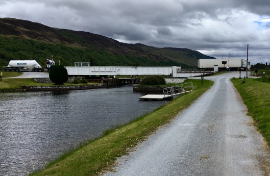
The first 3 miles was a retracing of my steps from Invergarry down to the Laggan Swing Bridge at the southern end of Lock Oich. Thereafter I picked up the canal link down to Ceann Loch and then Loch Lochy.

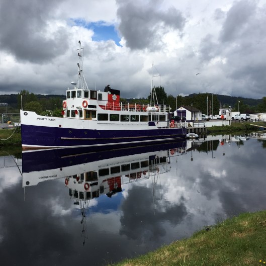
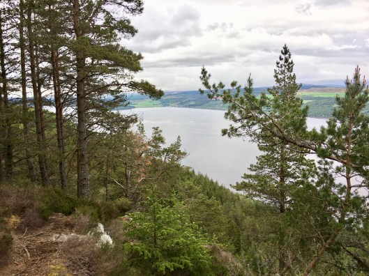
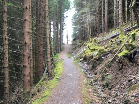
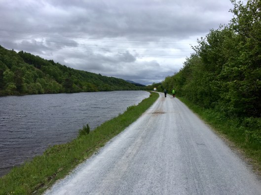
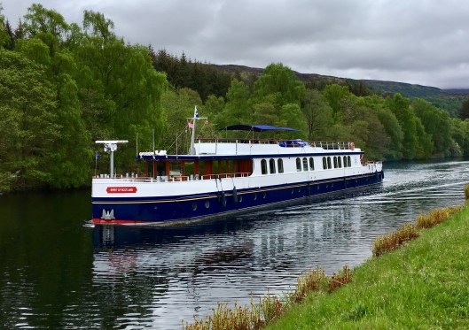
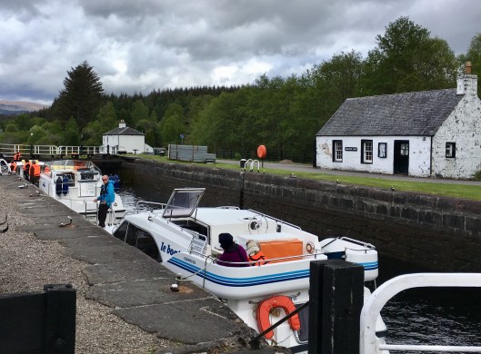
The canalside walk started well with a well-marked firm gravel track cutting through neatly trimmed grass and scattered broom bushes. On either side the hills rose steeply, blanketed with pine forests. From time to time the forests encroached upon the canal. As it was still early, only around 9am – I had started early in view of the distance to be covered – the waters were still and the bordering pines were reflected in the mirror-like stillness. Not a thing stirred on the water. In many ways it was quite idyllic and so it went on. And on. Mile after mile. I longed for some variation in outlook or elevation. Odd though it may seem, I wanted to be up in the mountains again looking down, not down in the valley looking up. The only respite was upon reaching Laggan Locks an hour and a half out of Invergarry. This delightful basin was busy with small leisure craft readying for movement up or down the Great Glen waterway.

IMG_4781.jpg

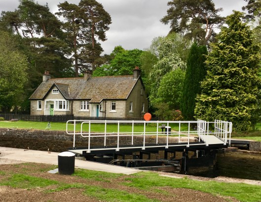
Apparently constructing this, the highest stretch of the canal at 32m (106ft) above sea level, was a major challenge. There were massive amounts of earth to be dug out. Up to 250 men worked here, using horse-drawn wagons on railways to take the earth away. By the 1870’s steamer trips along the canal were very popular. This would have been good for local hotels and shops but not for the lock-keepers’ wives. They were forbidden to hang-out washing when steamers were passing. I would have thought they would have been happy not to have their whites covered in smuts from the steamer boilers.

IMG_4783.jpg

Not far from the lock is Kilfinnan, indeed my route took me through it although it was hardly recognisable as a seat of historic foment. Kilfinnan was the burial place for the chiefs of the MacDonells of Glengarry. Apparently the 15th Chief, one Alasdair Ranaldson MacDonell of Glengarry, known as Wild Alasdair, stripped his estate of timber to finance a flamboyant lifestyle and evicted tenants to make room for sheep. He was a constant problem for the builders of the Caledonian Canal, demanding large amounts of compensation and chasing canal workmen off his land.

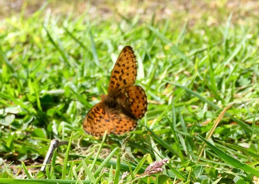
Today Kilfinnan is notable only for its view over Ceann Loch and the boulder-strewn bed of the river which empties Loch a’ Choire Ghlais up in the mountains to the west into the canal. And maybe the cuteness of its lambs of which there were plenty at this time.

IMG_4788.jpg

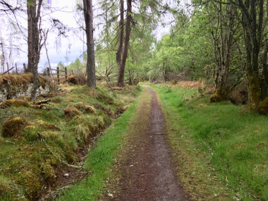
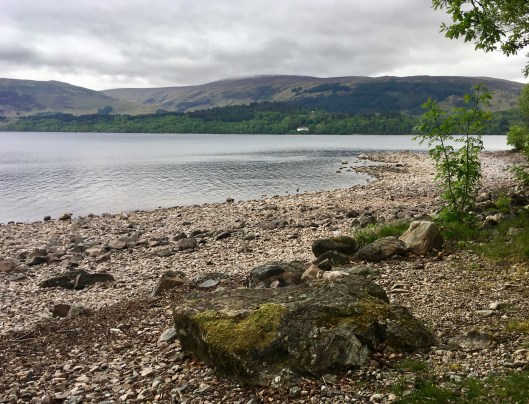
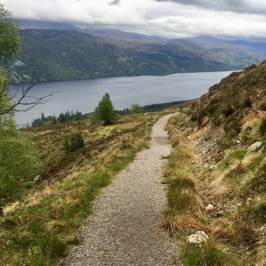
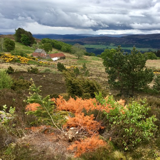
The next 6 miles or so were not especially noteworthy. The Great Glen Way followed a minor road variously through pine forest, deciduous woodland, or a mixture. Loch Lochy was ever-present on my left and devoid of craft seemingly kept at their moorings due to the increasingly strong wind raising white horses on the loch. My focus was on making progress south and even the occasional vista of bluebells did little to engage me. The tunnel vision wasn’t arrested until Bunarkaig, about 2 miles north of the end of the loch, at Gairlochy.

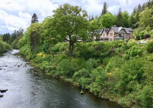
Bunarkaig was a gem of a lochside hamlet. As I passed, to my right were a series of houses of significant quality with well tended gardens and the Clan Cameron museum.

IMG_4813IMG_4816To my left was the loch, but with an interesting outlook and history. During the 2nd World War the Commandos had a training base at Bunarkaig. A small fleet of various craft were assembled to support commando training. These included whalers, cutters, rubber dinghies, bridge rafts and others. By all accounts the training was extremely realistic. No blank ammunition was used and the instructors were skilled in missing ‘but not by very much’ offering training as close to battle conditions as they could get without actually slaughtering half the trainees. This information came from one of 8 commemorative panels outlining the training undertaken in the area of which local people are rightly proud.

IMG_4823.jpg

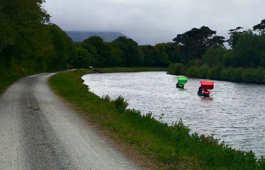
A further mile of so south I made it to Gairlochy after which there was nothing much to enjoy other that the flatness and straightness of the grey ribbon path, the quietude, and the fresh air being propelled at increasing speed in my face. I was probably lucky not to have had this sooner given the principal reason for walking the Great Glen Way west to eat is to avoid the headwind. No wonder the little craft heading towards me had makeshift sails.

IMG_4848.jpg

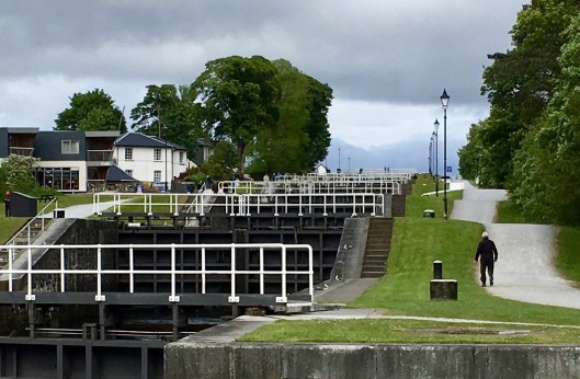
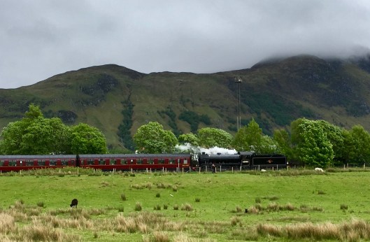
Eventually, after a further 6 miles of relatively uninteresting canalside slog, and with a degree of relief of which I was not proud given it was my choice to undertake this walk, I came to Neptune’s Staircase at Banavie. A short distance from Fort William, this is a staircase of eight locks built by Thomas Telford between 1803 and 1822. It is the longest staircase lock in Britain. The system was originally hand-powered but has been converted to hydraulic operation. The waterborne activity here and the number of visitors provided a most welcome respite and my spirits lifted. This was further helped when, unexpectedly, there was a whoosh of steam and the accompanying sound of a steam train getting underway. Each massively powerful and explosive piston stroke was just a little quicker than the last as it picked up speed departing Banavie station. I couldn’t see the train but I was to do so later.

IMG_4852.jpg

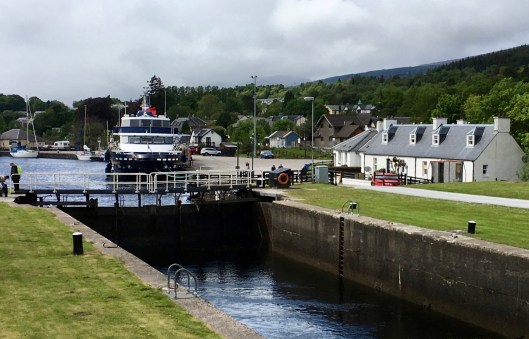
Once south of Banavie my spirits rose further at the prospect of being close to the end of this long distance trail, even though I still had nearly 5 miles to go to the final set of locks at Corpach which control access to the Caladonian Canal. It felt as though I should be able to smell sea air, but I couldn’t. Neither Corpach nor Fort William is on the sea which is, roughly, another 30 miles to the southwest, through Loch Linnie past Oban. It is however the end of the loch-controlled waterway.

IMG_4858.jpg

I walked on for a further hour and a half, past the Kilmalie shinty pitch at Caol, through Lochyside, clearly run-down but distinctly optimistic, and through Black Parks alongside the River Lochy into Inverlochy. Upon turning along the Black Parks riverside path I was treated to another whoosh of train steam as the locomotive went by, this time in full view. Hidden in the clouds somewhere beyond was Ben Nevis.

IMG_4862.jpg

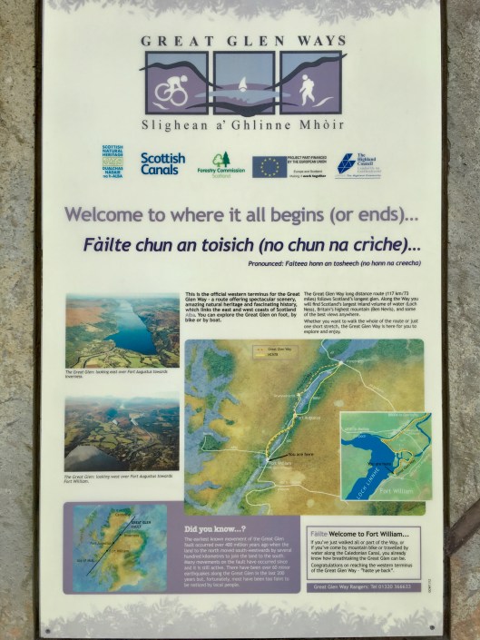
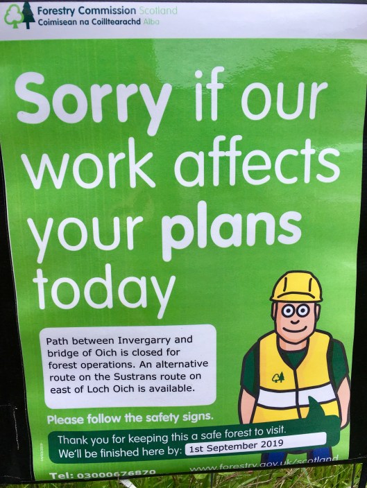
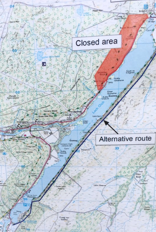
And then beside Loch Linnie, on the site of Fort William’s Old Fort, I arrived at the end (or the beginning) of the Great Glen Way.  After what should have been 78 miles but which, due to humans not walking in straight lines and thanks to the trail closure on the planned approach to Invergarry, turned out to be over 85 miles it was done. Over 4 very happy, healthy, exciting, surprising and enormously enjoyable days, it was complete. Today’s 25 miles had ended up being 28 but I could at last allow my feet to hurt as I shuffled to the best real ale pub in Fort William, the Grog and Gruel, for a beer, a sit down and a huge grin of pleasure.

IMG_4865.jpg

I love walking in Scotland. Thank you for being with me. Goodbye until the next time.

Day 3 – Invermoriston to Invergarry via Fort Augustus

24 Friday May 2019

Posted by andyjameswriter in The Great Glen Way

≈ 1 Comment

Today’s leg was supposed to be around 18 miles. As yesterday, there was a choice of routes. The low route skirted Loch Ness at a height of around 50ft for much of its 6 miles to Fort Augustus. The high route rose to 330ft and provided awesome views of the loch and the Monadhliath Mountains beyond although some of its 7 miles is in the forest. I chose the latter of course, not being a cyclist or a horse.

From Fort Augustus I was to follow the Caledonian Canal which links the southern end of Loch Ness with the northern end of Loch Oich. At the junction with Loch Oich I was to use the Invergarry link to get me to Invergarry for the night.

Once I had recovered from the wonderful surprise of Mark Horrell’s text early in the morning at the Darroch View B&B, and having consumed Mrs Morgan’s substantial breakfast my goosebumps and I headed off in glorious sunshine. The initial walking was easy along roads and good tracks, the River Moriston was in picture postcard form and my tread was light.

After a couple of miles of mixed deciduous and pine woodlands I reached the point at which the low and high routes separated. The latter took no prisoners and a well made track thrust upwards with some vigour. I didn’t see Mark and Edita at all on this day. I know they were heading all the way to Fort William. Unless they left Invermoriston earlier than me I suspect they took the low route. If so, that was a good call. The next half mile was relentlessly steep with no views. With dense pine all around the wildlife count was low and with rocks to my right even if there had been any life I wouldn’t have seen it. The purpose of this section was just to get up to where the views were.

Then through sweat-streaked specs the view appeared right on cue. The pine forest fell away and I was presented with Loch Ness stretching away to the right, a big dramatic sky above and a sunlit path heading south. Every drop of perspiration had been worth it. I was breathless, literally and figuratively.

There was not a soul to be seen. The silence was broken only by the crunch of my boots on gravel and the skylarks above and it sounded as though I wasn’t the only one in their element. What joy! I fleetingly recalled that hidden far below but well within earshot of those on the low route, the A82 lurked. But that was of no matter to me. Not yet at least. My path snaked across open land well above the noise and fumes of real life.

In due course the track wended it’s way lower and the open moorland gave way to pine trees of a dizzying height…

… and subsequently to deciduous bluebell-decorated woodland as we approached Fort Augustus.

This small town relies heavily on tourism. All needs are catered for, from riders, cyclists, walkers, sailors, and canoeists to those arriving by cars and buses all with the ‘Nessie’ theme central. I was amused by the fish and chip shop. As with many if not all Fort Augustus businesses a link to ‘Nessie’ was, apparently, essential.

For me the high point of my transit, not being hungry, thirsty, in need of anything tartan or a cute Nessie fridge magnet, was the canal. While the ‘Lock Inn’ was a cleverly word-played temptation my interest was focused on the hive of activity on the locks of which a flight of 5 lower craft from the top of the canal down onto Loch Ness. There were many craft large and small all being marshalled either up or down the flight. I was very impressed by the efficiency and control of this operation and it’s management by the lock team. I can’t really capture all the activity in a single photo but hopefully you’ll get the gist.

This proved to be the last bit of waterside life for some time. Apart from the occasional, surprisingly occasional given the activity in the flight of locks, pleasure craft and a handful of walkers or cyclists there wasn’t a lot of movement on the path ahead. The couple in the distance in the photo below were Dutch. The size of their packs spoke of camping rather than using B&B, hostels or hotels. I spoke to them later, after they dubbed me ‘professional’ zipping by in T-shirt and shorts double-poling. They were loving Scotland and the fine weather although they were fully dressed for rain. Despite this they were in very good spirits.

After 3 miles or so of flat, level greyness I came upon Kytra Lock. This picturesque lock is one of 2 that manage the water level between Fort Augustus and Loch Oich.

The next would be Cullochy Lock and after the previous hour’s quietude I expected more of the same. But it was not to be as the handsome ‘Spirit of Scotland’ chugged into view. Sadly it was empty but maybe it was just being brought into service and the Captain offered a cheery wave.

Then it was ‘head down’ and power pole to the next lock. Cullochy Loch was much busier than the first.

Not long afterwards the welcome sight of the Aberchalder swing bridge could be seen . The only regret was that I was still being ‘tractor-beamed’ to it by the same monotonous grey ribbon, i.e. the characterless path. Even from a distance I could see the A82 was busy but I was pleased to see it as from there I would be in woodlands again and in Invergarry, my target for the day anticipated in under an hour.

But it wasn’t to be. On reaching the woodlands I found this:

Drat! My route was blocked! As you may be able to see the footpath is within the red-shaded Closed Area.

I considered ignoring it and going anyway but was advised by the bridge master that the closure was patrolled and I would be turned back. I then walked along the A82 for 20m or so to see if it was viable to take the road, but it wasn’t. The A82 is very busy and not especially wide. When any combination of trucks and coaches pass they take up the full width of the road leaving no space at all for walkers and they whistle by at an alarming speed bearing in mind their proximity. Nope, I had no choice but to bite the bullet and use the alternative route. Instead of a short walk of around 3 miles down two-thirds of one side of Loch Oich I now had to walk the full length of the loch down the other side as far as the North Laggan Bridge and then back up to Invergarry. My walk had just increased by 5 miles. The 18 mile day was now 23. Hurrah! I like a good walk.

As if to rub salt in my wound I was unable to cross the bridge until it had opened to allow a craft to pass. No matter – it was interesting to watch the operation of the bridge while swallows performed in the nearby field.

IMG_4704.jpg

Once across, it was clear the route down the east side of loch was going to be something new. It was a disused railway line. A helpful nearby information board advised that this section of line was part of the Invergarry and Fort Augustus Railway, built between 1897 and 1903, which was intended to be the first stretch of an Inverness to Fort William railway following the Great Glen. Its tracks, bridges and tunnel were all built to mainline standards but the plan fell through. Competition between the various Highland railway companies meant that the second stretch of the line to Inverness was never completed. There was not enough local traffic to support this part of the line in isolation and it finally closed in 1946. While its tracks were sold for scrap the tunnel remains.

IMG_4716.jpg

Hereafter it wasn’t the most interesting of routes being dead straight with elevated damp woodlands on the left and mixed woodland and scrub to the right with the loch beyond. However increasing numbers of rhododendrons and occasional broom added colour and the A82 was too distant to disturb the peace and birdsong.

There was a bonus towards the end of the line: Invergarry station, or at least a platform with a sign and a loco under reconstruction. A nearby noticeboard advised that this was the work of the Invergarry Station Project.

IMG_4729.jpg

Not long afterwards my trek south was brought to a close by the North Laggan bridge which afforded dry passage to the Invergarry side of the loch and I was once more able to think of a shower, a beer and dinner.

There was just a short section of the A82 to negotiate in order to reach the mountain track during which the prospect of being battered at speed by a consignment of live fish loomed large.

IMG_4740.jpg

Eventually, after more miles than had been planned around the lock to be known as Ouch rather than Oich, the Invergarry Arms Hotel hove into view. Standing proudly by the side of the River Garry this venerable and award winning hotel has been welcoming guests since 1885. Today that’s where my head was to be rested. That is after a jolly fine dinner and a wee dram of Caol Ila, my favourite malt.

IMG_4759.jpg


The Big Reveal – who was that Masked Man?

23 Thursday May 2019

Posted by andyjameswriter in The Great Glen Way

≈ Leave a comment

I left you at the end of yesterday’s blog in a state of anticipation as to the identity of the mystery man. You remember, the chap in the Invermoriston Arms missing his cycle gloves. Some of you will know him while others will need some introduction and the context.

During the first couple of days of this week I and a cycling couple have been a ‘tag team’. Barely out of Inverness on day 1 we met early on and assisted each other navigate around a building site. Me being on foot with go-faster trekking poles I was more fleet than the cyclists as they were pushing laden bikes uphill. Of course they cheerily overtook me later but then I overtook them while they took lunch and I pressed on. Naturally they passed me again later. On each occasion pleasantries were exchanged but there was no recognition.

On day 2, I made an early start but in due course the tag-team couple overtook me. However they were tempted by a trackside coffee shop (curiously hidden) and the guy spent some time trying to find the vendor and his offerings, without success. Meanwhile the lady had pressed ahead, presumably concluding that a cup of cold coffee wouldn’t be her cup of tea. While his foraging was underway I caught up with the chap. He explained the situation and we both moved on.

It was he and his cycling partner who I saw in the Invermoriston Arms later that day, but with their backs to me and my focus on the most excellent Red MacGregor there was, again, no recognition. Even when he returned to look for the missing gloves there was none.

Then early on the morning of Day 3, I received a simple personal Twitter text saying: “Hey Andy, are you they guy who keeps overtaking these two people on mountain bikes?” (Accompanied with a photo of the couple in cycling gear). And it was indeed me.

The goosebumps started when I saw the Twitter handle: it was from Mark Horrell. Indie author, hugely influential mountaineering blogger and Everest summiter.

“So what”, you may say. Let me provide some context as to his place in my life.

Back in 2013, when I still harboured the belief that I could stand on the summit of an 8000m peak, I was preparing for an attempt at Cho Oyu, the 6th highest mountain in the world. In scouring the internet I found a great ebook called ‘The Wrath of the Turquoise Goddess’. I absolutely loved it and subsequently bought another by the same author: ‘The Chomolungma Diaries’ which was an account of the author’s attempt on Everest. In particular I loved the author’s written style. He presented things in a matter-of-fact, entertaining and informative manner which appeared to be based upon daily blogs. I was thus inspired to do likewise. I went on to blog extensively during my attempt on Cho Oyu and upon returning I self-published a book: ‘The Turquoise Goddess – not just about the summit’. Some of you were kind enough to buy it. (It’s still available on Amazon 🤣). This was achieved. entirely due to my reading of Mark Horrell’s work.

Then in April 2014 I was in Everest basecamp with Tim Calder and others to attempt to summit. In the event that attempt was stymied by the dreadful impact of the Good Friday avalanche, which resulted in the death of 19 Sherpas and, through political incompetence, closure of the south face for that season. Nonetheless I still blogged extensively and discovered a love of wild trekking. Upon returning to Kathmandu in early May I was lucky enough to meet Mark in a well-known bar and thanked him. That was the only time we met but the legacy lived on.

Within a few days I learned that I had been made redundant and with my wife Clare’s assistance I decided to try writing as a profession. Again due to Mark’s inspiration and Clare’s belief and encouragement, that summer I wrote, and was paid for, several pieces for the now defunct magazine ‘The Ionian’. I even had a cover photo published. I still fondly remember receiving my first acceptance email from the editor. We were on a beach in Corfu and spent more on celebratory wine than I grossed for the article.

Was I made as a writer? Er, no. In the event, while I loved writing, it was never going to provide a living wage. In October 2014 I returned to gainful employment with CLS, which I loved. Nonetheless I look back on the summer of 2014, which was not a great period for many people, with enormous pleasure and I place Mark Horrell’s influence right at the centre of it.

So, Mr Horrell. It was a real pleasure to meet, albeit in transit and fleetingly, you and your beautiful and talented wife. She being the lady I now know to be Edita, a humanitarian aid worker and the first Lithuanian woman to summit Everest.

That’s it. The big reveal is over. Thank you all for bearing with me. I appreciate this blog won’t have been hugely entertaining to some of you but I believe in telling it like it is, or was. This week has been fantastic fun for me and it has been brilliant to be blogging again. It, and your responses to date have shown me that enough people like my writing to continue. Thank you so much.

As a result I will continue to blog travels and will now complete the blog from my Upper Dolpo trek in late 2016. Moreover I will endeavour to write the related book I promised: ‘The boy in the orange jacket’ which will attempt to explain Dolpapan transhumance. It will take a while but I will do it.

Why? Due to Clare’s encouragement, your support and Mark’s inspiration.

Thank you for indulging me. The full Day 3 blog will follow tomorrow.

Broom and primroses, and an extraordinary encounter

22 Wednesday May 2019

Posted by andyjameswriter in The Great Glen Way

≈ 7 Comments

Wow. Just wow. Before I test your patience with a second Great Glen Way blog I just have say thank you for the comments, public and private, on yesterday’s missive. You give me confidence to try another. This is me grinning and feeling blessed, with the much more interesting Loch Ness in the background. Thank you. 😀

This is Day 2 and my route continues southwest, from Drumnadrochit to Invermoriston. For the statisticians out there this is slightly more than the middle third of Loch Ness. It was a relatively short day at around 14 miles with a choice of following a ‘high’ route or a ‘low’ route.

The low route skirts the loch and is ideal for cyclists and horses. The high route has some significant ‘ups and downs’ but the ‘ups’ are rewarded with magnificent views of Loch Ness and on a clear day Ben Nevis may be seen well to the south with the Cluanie Mountains visible to the west. There was no choice to be made.

However let’s not jump ahead. They follow the same path for the first few miles then split. The route out of Drumnadrochit was a series of beautiful but uninspiring tree and scrub-lined minor roads significantly improved by being travelled following a wholesome scrambled egg and smoked salmon breakfast. As I gained height I noticed a resemblance between the flora and scrambled eggs. I wasn’t hallucinating. Rather the broom, previously merely present, was now more abundant. Never had I seen such coverage. We southern Englanders are familiar with the extensive show of rapeseed blooms in springtime but this broom was even more dramatic given the climate.

Despite its visual impact you had to be there and I know there is only so much fun I can generate for you through tales of broom-endowed minor roads.

Bye and bye I entered woodlands and, oh, the aroma of wet foliage and damp soil. Many birds were chirruping but with the massed chorus of chaffinches exultant.

This verdant environment was short lived and confined to the loch side and other low lying areas. In due course I headed towards higher terrain and the occasional glance of the loch was soon followed by the split of routes.

Upwards I trod on the ‘high route’, enjoying the breeze and freshness afforded by the more open ground and revelling in the views to my left and ahead. Despite the threatening skies the worst that happened were a few sprinklings of Scottish rain. Hardly rain at all but sufficient to reinvigorate the aromas of soil and vegetation.

Then my excitement level increased further. There, right down at the end of this loch, beyond even the second loch yet unseen and then on some, was Ben Nevis. It was hard to see, nestled as it was behind Carn Mor Dearg and it’s glorious arête (surely the best way to reach the summit of The Ben short of scaling one of several North Face routes with ropes and metalwork) and with its head in the clouds (sigh).

Then the primroses started to appear. First in ones and twos then in families. It was becoming primrose central. If anyone knows why, in this place alone (so far as I know) the primroses have found kinship with thistles please tell me.

Then, joy of joys, a glorious winged beauty landed nearby. The Pearl-bordered Fritillary is orange with black spots on the upperside of its wing and has a wingspan of 38–46 mm (1.5 to 1.8 inches). It is a gem in the wilderness and it just sat there and let me photograph it.

Between areas of high ground a little treasure was stumbled upon; the Troll Bridge. This quirky but very practical bridge was opened in 2014 and features a notice board showcasing Tröll-related poetry, including some by local schoolchildren.

Moving on I headed into more open ground, much of it extensively logged. Out of the blue I came across the The Viewcatcher. A plaque says it was made from Caledonian Pine and local stone and was designed to highlight a stunning view. And it did so!

The view was that of the Cluanie Mountains to the west. But without in anyway decrying the value and necessity of sustainable logging, the reverse view was less easy on the eye. Not on mine anyway. I hadn’t troubled you with this before, but there is extensivelogging.

And that’s about it for Day 2, except for one quite remarkable encounter while enjoying a much anticipated pint of Scottish real ale in the Invermoriston Arms late in the afternoon. I was fortunate to find the Orkney Brewery’s Red MacGregor, a 4% ABV ruby ale which was the Champion Beer of Britain last year in the bitter category. But that wasn’t the remarkable encounter.

When I went into the bar there was a couple in a window seat. Dressed in cycle gear they had their backs to me while I was at the bar ordering the Red MacGregor, then they left. I hadn’t recognised them even though our paths had crossed a few times during Day 1. I then occupied their table and shortly after the man returned to see if he had left a pair of cycle gloves at the table. He hadn’t and that was the end of the encounter. Early the following morning I had a private Twitter message from him.

He had seen yesterday’s blog and he knew me, and me him. Stay tuned. I’ve been in goosebumps all day about this…

Are you out there Nessie?

21 Tuesday May 2019

Posted by andyjameswriter in The Great Glen Way

≈ 11 Comments

It’s an uncommonly fine day in the Highlands of Scotland.

Earlier today I arrived in a wet and grey Inverness having taken the first train there out of Glasgow’s Queen Street station. Why? Because Inverness is the start (or end) of the Great Glen Way; an iconic 78 mile long distance path. It links Inverness on the Scottish east coast and Fort William in the west via a series of waterways including Loch Ness. However, much of the Great Glen Way is along the glenside rather than the shoreline mostly for the magnificent views afforded by the elevation but not least as much of the shorelines are hogged by the A82, a quite busy main road.

At just after 11am, and having bought a waterproof cover for my rucksack carelessly left at home, I set off along the River Ness. Passing Inverness castle to my left I approached Inverness cathedral over the river to my right. And the magic started. A piper was playing on the other bank of the river by the cathedral. He wasn’t performing or busking. He was just playing, seemingly for himself. And now unseen in this photograph, for me.

With joy in my boots, the rain having abated and with a shiver down my spine from the impromptu piped welcome, I continued to the official start (or end) of the Great Glen Way.

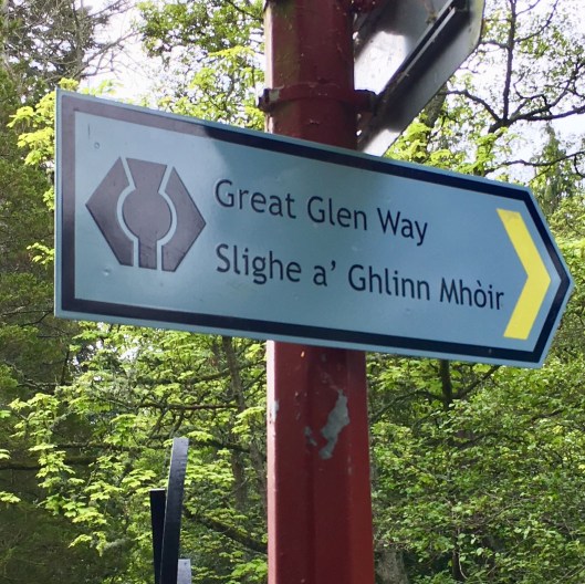
I should explain that the Great Glen Way can be walked in either direction. There is no ‘right’ way or ‘wrong’ way. However most people walk west to east, from Fort William to Inverness to benefit from having the prevailing wind at their back, rather than in their face. I’m doing it the other way for logistical reasons to tie in with train timings and so that, as I’m doing the walk over 4 days rather than the customary 5, I will have a 25 mile leg as my final day rather than my first day. Mercifully there is no significant wind forecast so the direction of travel makes no difference.

My journey southwest will be on the northern side of the Great Glen watercourses. These comprise not only the star of the show and her leading man, Loch Ness and Loch Lochy, but several other smaller waterways, including the Caledonian Canal which links Ness and Lochy.

So first I had to cross to the northern side of the River Ness. This was achieved at the lower Tomnahurich Bridge a swing bridge alongside which was moored the Jacobite Queen, a pleasure cruiser offering waterborne tours of Loch Ness.

Then is was time to head for the hills, following the Great Glen Way (GGW) route markers between the Highlands Rugby Club and the Inverness Botanic Gardens. Thankfully the markers work in both directions. New builds and more traditional dwellings soon gave way to woodland tracks based upon ancient drove routes. These were flanked with silver birch, laurel and occasional pine with the air redolent with the heady aroma of damp undergrowth. The air was so damp it was impossible not to sweat although, in truth, it was not hard going.

Mile followed mile with many changes in outlook, from close woodlands through wider-tracked vehicle-supporting lands to open moorland. However the look of much of this was spoiled by logging.

But even here in these more barren areas springtime fecundity was rife. There were many butterflies including the orange tip and small white. The new growth on pines was clear with almost all pine branches seeming to have been dipped in a lighter, fresher, hue of green.

Then after, eventually, clearing the woodlands I was rewarded with my first glimpse of Loch Ness through the trees. And shortly after there was a clearing. Sadly no ‘nessie’ in sight but nonetheless a glorious vista over one of Scotland’s most iconic lochs.

Unsurprisingly it was now raining. What was unusual was the lack of accompanying howling wind and drop in temperature. As a result while my newly purchased pack cover was called into service I didn’t bother with a waterproof on the grounds that it wasn’t cold and I was waterproof. In the event the rain was intermittent and I soon dried. More importantly I was rewarded with a glimpse of Urquhart Castle on a promontory, misty and distant to be sure but there it was. Urquhart Castle was fought over many times and was variously controlled by the English King Edward and the MacDonald Lord of the Isles in the Middle Ages. It was transferred to state ownership around 100 years ago and is now among the most visited of Scotland’s castles.

Shortly after, and having gone through several iterations of ‘rain/no rain’ I was in the outskirts of Drumnadrochit, where I was to spend the night. Having come over 20 miles from Inverness, seen almost nobody including ‘nessie’, but with all senses newly re-tuned to the beauty, quiet and richness of the Scottish Highlands I headed for the bar in the Benleva Hotel where I was to spend the night. The hotel that is, not the bar.

Enter your email address to subscribe to this blog and receive notifications of new posts by email.

Join 105 other subscribers
Follow Andy James on WordPress.com

Blog Archive Categories

  • Dolpo trek (45)
  • Lefkas (3)
  • Mont Blanc June 2019 (8)
  • The Great Glen Way (6)
  • The Haute Route (10)
  • The West Highland Way (6)
  • The Writing Journal (6)
  • Walking London – the Capital Ring (4)

Blog at WordPress.com.

  • Follow Following
    • Andy James
    • Join 47 other followers
    • Already have a WordPress.com account? Log in now.
    • Andy James
    • Customize
    • Follow Following
    • Sign up
    • Log in
    • Report this content
    • View site in Reader
    • Manage subscriptions
    • Collapse this bar
 

Loading Comments...