
Well it would be except we’re not yet even close to home and the way will be anything but straight!
Days 17 onwards will see us trek from Takla Khola via Tajachaur to Gamgadhi on the Great Himalaya Trail High Route before heading south on a lesser tail to the airfield at Jumla. Said quickly that sounds very reasonable but in this final 5-day section of the trek we will cover 80 miles; 40 miles over 3 day on the GHT High Route to Gamgadhi and another 40 miles over 2 days heading south to Jumla. Those last 2 days had better be downhill!
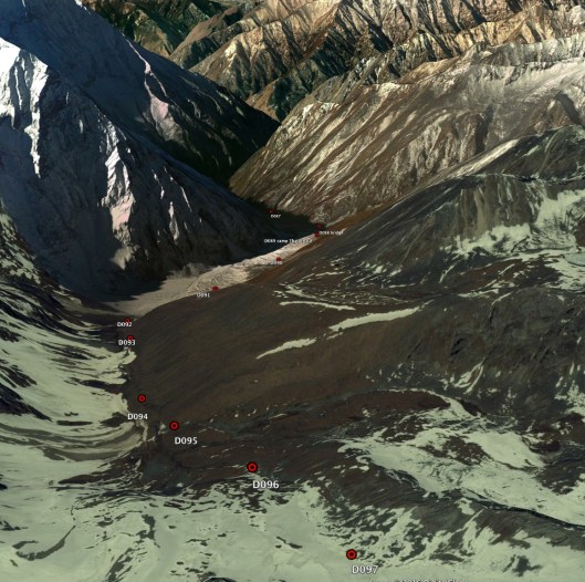
On the first day, scheduled to be 19th November but that will depend on progress, we will cross our final significant pass, the 5150m Chyargo La before heading down the Chham Khola to the camp site at Thajachaur (4050m). At about 9 miles this won’t have been our longest day but the pass is still among the highest so we won’t be jogging. The picture below, inevitably from the amazing Google Earth, shows what the ground might look like from the pass and the route as it snakes down the valley.
On day 18 we continue heading along the river and progressively downwards. After Shilenchaura Kharka at just under 3000m we pick up the main river in the area, the Mugu Nadi, and follow it to Tiyar. As it is broadly downhill all the way we should be able to cover a fair distance and are planning on 18 miles. We will also have a reduction in height of over 500m to 2418m as we approach the village of Tiyar which sits at a major river junction.
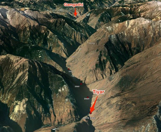
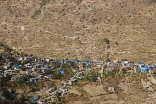
On day 19 we will follow the Mugu Karnali Nadi along its well populated valley to Gamgadhi. While not visible on the photograph above, there are many villages of varying sizes on this stretch and we should have no issue finding food, and possibly lodgings as a welcome alternative to camping as the novely of the latter may have worn off several days previously. As can be seen in the photograph of Gamgadhi (below) this is a significant settlement in which we should find resupply facilities. While Wikipedia offers no population figures it does report a community FM radio station, Radio Mugu, on 107.4 MHz. It really does. Here is its web address: www.radiomugu.com.np
From Gamgadhi we head south away from the High Route and while still 40 miles and 2 long hard days away Jumla will now be feeling closer. We will spend the night of day 20 at the village of Nauri Ghat before continuing on what should be our final day, day 21, to Jumla and its airport which will doubtless look like an oasis.
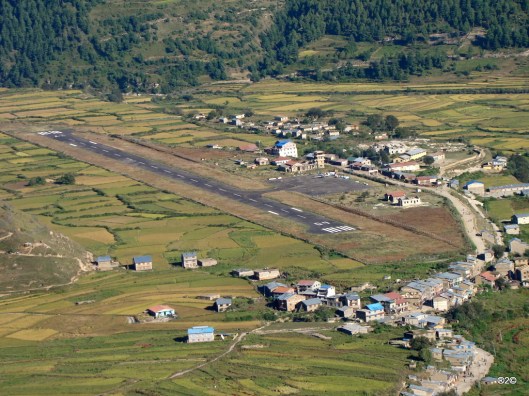
Whether we will arrive in time to fly out that day or not we shall see. I wouldn’t expect that we would, so the evening will be spent in welcome relaxation before returning to Kathmandu 2 days hence via a stopover at Nepalgung. There are no direct flights to Kathmandu from remote Jumla. At this stage we just hope to make it this far and will worry about getting back to Kathmandu later.
I hope very much to share our journey, which starts in earnest a week tomorrow, with you. Thank you for reading the preparatory blogs which will complete over the weekend with an insight into trek clothing and equipment.

Wow! You have been busy! There’s so much more to this hill climbing than I ever expected. I admire your determination and really hope you make it this time.
Good luck 🍀
LikeLike
Thanks Laura!
LikeLike