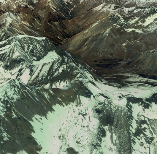
The next 5 days (days 12 to 16) see us heading into what looks from Google Earth and the map to be a 40 mile long roller coaster of high passes and river valleys, the Kholas. Following the toughness of the first 5 days as we rapidly gained height out of Jomsom, the second quarter of our trek was predominantly through high-sided valleys. That will end dramatically after Saldang. The picture below hopefully gives you the gist of the terrain. The high points are no fewer than 4 passes of over 5000m, including the highest of the whole trek, Nyingma Gyanzen La at 5563m (over 18,200 ft), and one relative minnow, the 4813m (15,790 ft) Yambur La. This is what the overall section looks like with the map overlay showing the route and planned overnight stops.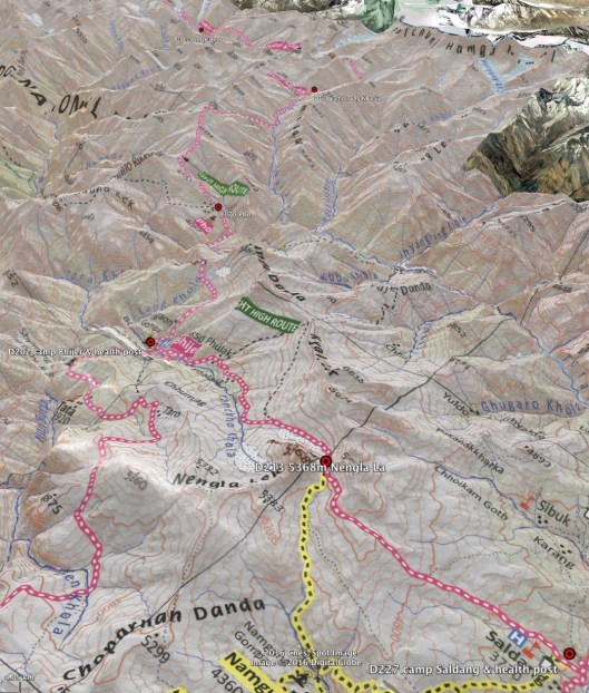
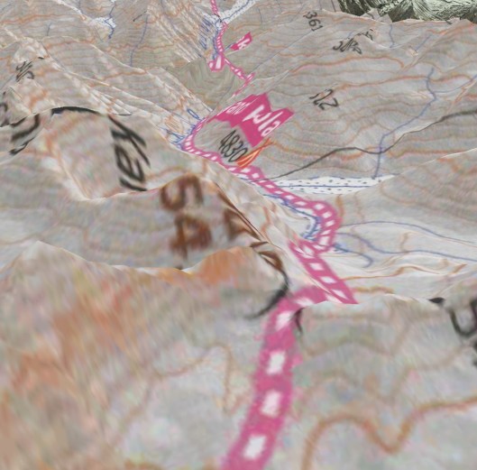
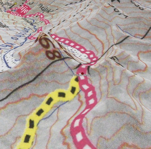
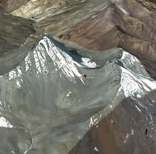
On the first of these days (day 12) we traverse the Nengla La (5368m) (see photos below with, and then without, the map and route overlay and with Bhijer in the distance) before stopping shortly after the glacier. This is a relatively short trek in light of the 1600m (5250ft) height gain from Saldang following several days in the Panjyan Khola and the short hop over the Khoma La. The obvious point peak to the south-west of the pass is Nengla at 5747m (18,855ft).
By way of a rest the following day (day 13) we head for Bhijer via the Yamchho Khola. This valley walk should be a relatively straightforward matter before we head back up on the following day (day 14) to Pho, nearly 10 miles distant over another pass, the 4813m Yambur La and via Pho Kharka into Tora Khola.
The perhaps the biggest day of all, day 15, which I expect to be a trek of around 8 hours not including stops, over the massive Nyingma Gyanzen La before heading back down to Pung Kharka via the Swaksa Khola. This is a Google Earth-eye view, again firstly with the map countoured and then without.


The final day of this quadrant, day 16, we head for Takla Khola. This will be another big day of around 8 hrs trekking covering 14 miles including a traverse of Yala La (5414m) before dropping down into the Chyandi Khola and then crossing final ridgeline to Takla Khola. Our intended camp can be seen on the first photograph beyond the glacier and marked by a red wigwam and the height marked as 4830m, a mere c.600m below the pass. We should prepare for a chilly night.