• About
  • Photographs
    • In Praise of Agiofili Beach
    • Corfu’s Most Beautiful Village?
    • Making a splash in Vassiliki

Andy James

~ A Writers Journey

Andy James

Category Archives: Walking London – the Capital Ring

The Capital Ring Day 3 – the green green grass of home

16 Sunday Jun 2019

Posted by andyjameswriter in Walking London - the Capital Ring

≈ 1 Comment

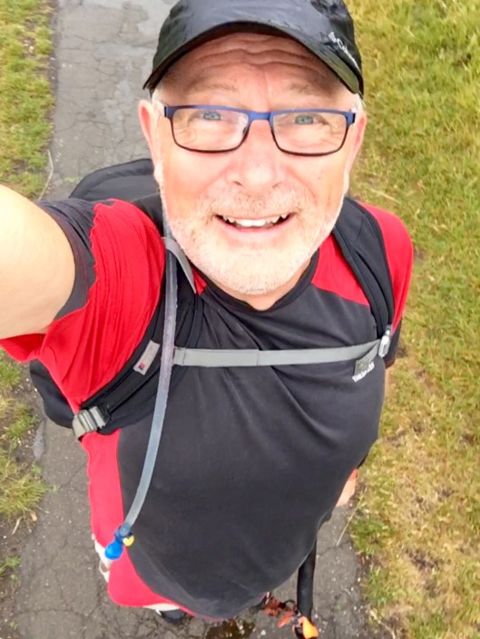
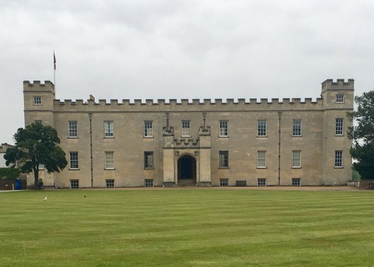
Today is the third and final day of my canter around London’s Capital Ring, ante-clockwise from my starting point close to the Osterley Lock, in Hanwell. The forecast today was for rain by 11am. In light of that, following a light breakfast of cereal and fruit juice I left my lodgings at 5:30 to get as much as possible of this final leg completed in the dry.

The general route to the finish from Haringey was via Highgate, East Finchley, Hendon, Wembley, Harrow and Greenford. A distance of around 25 miles.

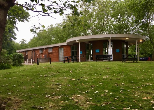
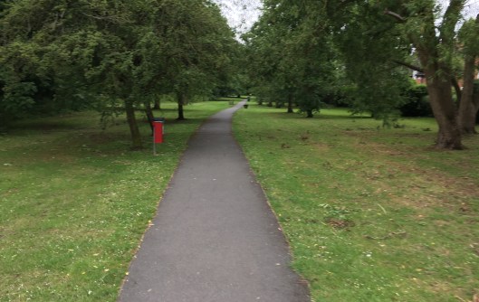
Retracing my steps to where I left the route yesterday, I entered Finsbury Park at 5:45 and it was surprisingly busy for that time of day with dog walkers and joggers. Finsbury Park was one of the first of the great London parks to be laid out by the Victorians. It tries to offer something for all tastes, including open green space and extensive mature trees including an arboretum. There was also a cafe (closed at this time of day), a lake, a children’s play area and sports facilities including football pitches an athletics track and a skatepark. The photos that I took don’t do justice to the size and range of the park facilities so I will show you only the cafe. If only it had been later I might have been tempted.

IMG_5236.jpg

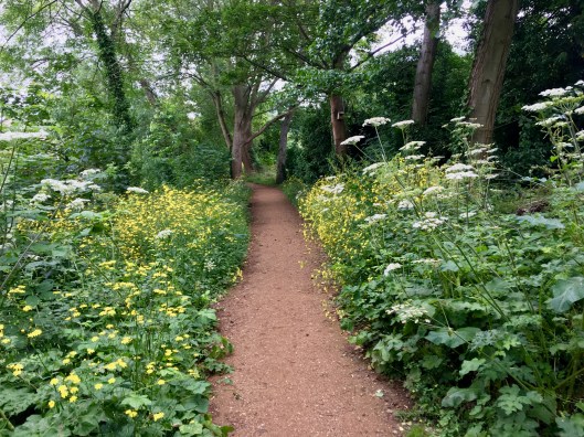
While the park was good within itself, it’s most important aspect for me was as the start of the Parkland Walk. The Parkland Walk is a 2.5-mile (4.0 km) linear green pedestrian and cycle route which follows the course of the old Edgware, Highgate and London railway line that used to run between Finsbury Park and Alexandra Palace, through Stroud Green, Crouch End, Highgate and Muswell Hill. The Capital Ring uses the section between Finsbury Park and Highgate. The walk was declared a local nature reserve in 1990 and is London’s longest such reserve.

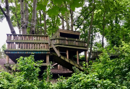
Upon starting the walk immediately after crossing main railway line into Kings Cross, the birds were plentiful. Typically robins, blackbirds, crows and wrens but with magpies and others birds less easy to identify too. For most of its length the scenery was unchanging; the unprepared earthen and stony broad pathway flanked by grass and bushes backed by deciduous trees, most commonly oak. However after about half a mile, shortly after I passed under the A1201 my eye was caught by the Cape Adventure Playground at Crouch Hill. This play and youth project building was renovated and reopened in 2013 and offers opportunities for children to explore nature and be adventurous outdoors. That struck a chord with me. This photo shows only a part of the extensive treehouse, zipwire and walkways.

IMG_5244.jpg

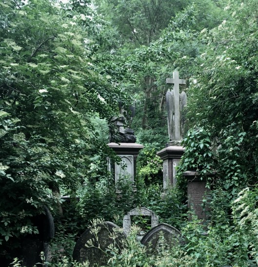
On reaching Highgate I walked through Queen’s Wood, thought to be a direct descendant the original British ‘wildwood’ and so alive with birdsong at this early hour and I was to have progressed through Highgate Wood to Fortis Green. But that was not to be. Highgate Wood was locked until 7:30 and it was only 6:45. I found an alternative, pavement, route to Fortis Green and rejoined the Capital Ring just before Cherry Tree Wood, nestled at the end of a wide sleepy road lined with trees, cars and well-to-do houses with gardens. Cherry Tree Wood was not all trees and included a wide open space and a well-kept childrens’ play area. It also included a little while building offering facilities that I should have used prior to leaving Haringey, and the door was open and the inside uncommonly clean. I liked Cherry Tree Wood very much.

IMG_5264.jpg

After the peace, solitude and relief of the little white building and the surrounding park it was a bit of a shock to emerge into full rush hour East Finchley style. It wasn’t unpleasant but it was very busy indeed at 7:15. I didn’t loiter as I had a lot of pavements to beat before the next green oasis in Hampstead Garden Suburb. Finding my way through the maze of clean but narrow alleyways in a very nice area of East Finchley just north of Falloden Way (otherwise known as the A1) was fun but not conducive to speed. Eventually, having crossed the A1 to the Lyttleton Playing Fields and the quaintly named Mutton Brook I was back into green space, albeit a noisy green space as it ran beside the A1 heading west. But it was a delight. The birds and squirrels didn’t seem to mind the road noise, or were used it. I mused how lucky I was to be down in the little strip wood and wondered how many of the drivers rushing past were aware of this little bit of heaven barely 30 feet from their exhaust pipes and impatient horns.

IMG_5273.jpg

At the junction of the A1 and the North Circular Road, i.e. the A406 – allegedly Britains noisiest road – a signpost told me I was on the Dollis Valley Greenwalk. This is a footpath route in Barnet between the Moat Mount Nature Reserve in Mill Hill and Hampstead Heath and is about 10 miles long. I was grateful for the information but at the time was focusing more on crossing the road. At approaching 8am the rush hour was at full swing.

IMG_5278.jpg

Without tarrying I headed to Hendon, just north of Brent Cross, anxious to use the pavements to gain some speed before again being distracted by greenware. I was approaching home territory and knew where I was again – an odd feeling following the last 24 hours or so. I recognised the A41 Hendon Way and crossed it quickly before crossing the M1, the mainline to St Pancras, and the A5 in rapid succession. Ahead the A406 flyover at Brent Cross was evident. The scene was at odds with what I had become used to and I was glad that the greenware to which I had become accustomed was much more extensive that the concrete and asphalt. Indeed, there was even greenery forcing a life between the concrete and asphalt.

IMG_5288.jpg

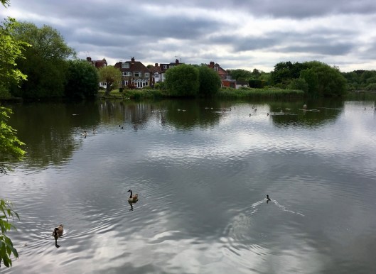
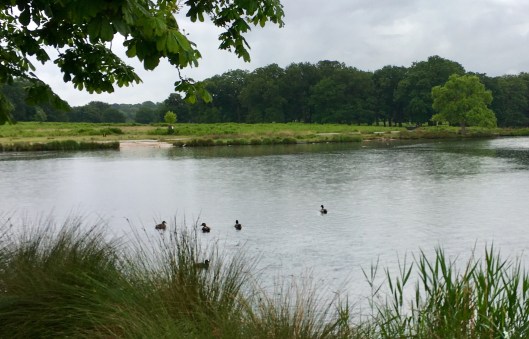
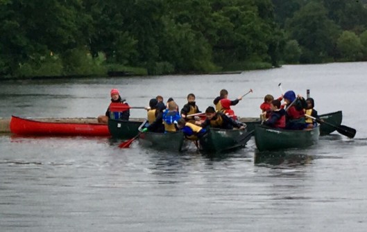
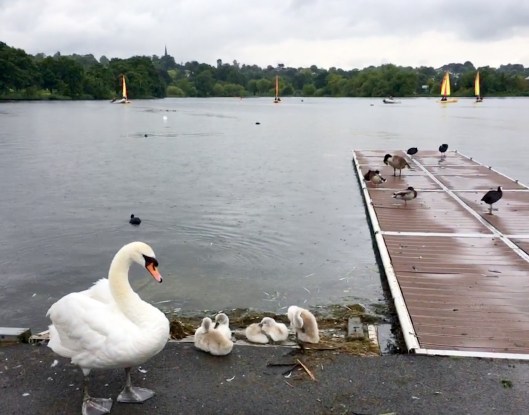
Then, in no time and little distance, it was almost quiet again. Around 300 yards from the concrete and asphalt, down Cool Oak Lane, I came to the Brent Reservoir, more informally and whimsically called the Welsh Harp Reservoir. This 420 acres of open water, marshes, trees and grassland is less than 10 miles from the centre of London, just a stone’s throw from a major road and rail corridor and is adjacent to the massive Brent Cross shopping centre. It is designated a ‘Site of Special Scientific Interest’ and it is home to the Welsh Harp Sailing Association. I designate it magic for it is nothing less. The photos below are just two small parts and regrettably don’t do this beautiful area justice.

IMG_5292.jpg

IMG_5300.jpg

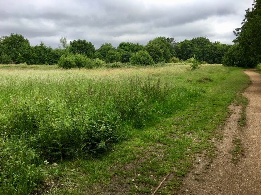
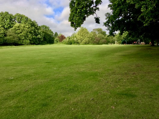
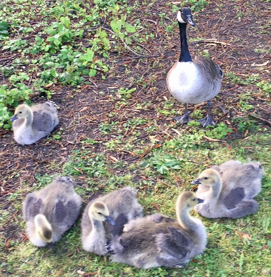
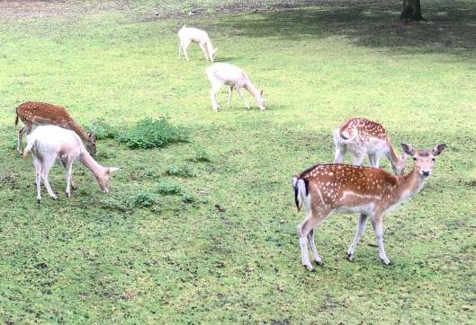
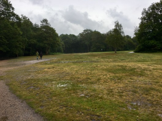
There followed just 15 minutes of pavement work to reach another huge natural open space.  Fryent Country Park is 250 acres of unspoilt countryside amidst the suburbs of Brent just north of Wembley Park; not somewhere I had expected to have such a lavish spread of green. Bisected by the A4140 Fryent Way, the park consists of meadows, ponds, lakes, hedges and woodland, and is a designated nature reserve. Apparently over 800 species of wildlife live here, amongst them 21 types of butterfly and 80 birds. Some of these were perhaps still asleep as I passed between 9:30 and 10:00 but it was a fantastic area of wildness to walk through. The area to the right of the road is predominantly open grassland with lanes cut to enable easy walking.

IMG_5311.jpg

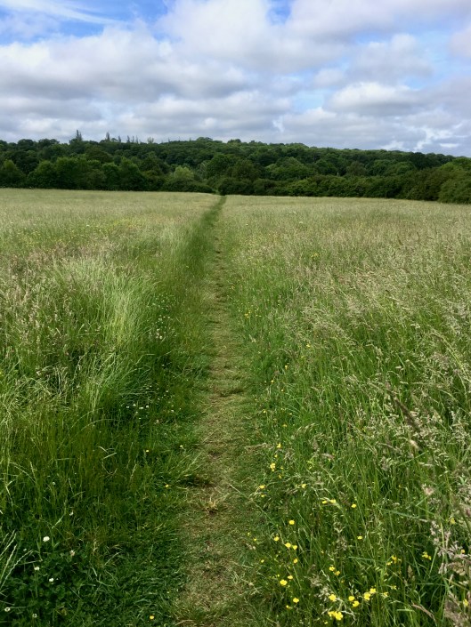
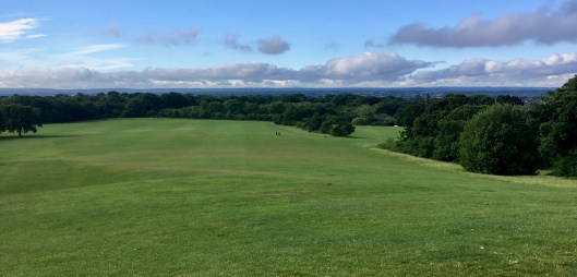
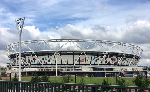
The park is open 24/7 and there is a small area for ponies to graze on as there are stables nearby. There is a car park off the road through which I passed when moving to the area of the park on the left hand side of the road. This area, seen towards the top of the photo above, is quite different in character to the other side, being predominantly wooded and on a hill. At the top of the hill is the delightful little Barn Hill Pond from which there are superb views across Wembley Stadium and further across London if, as today, the weather is fine.IMG_5315.jpg

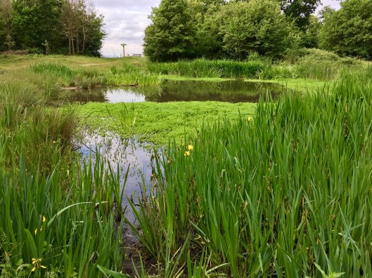
From the park my route continued through unnamed greenery alongside the Wealdstone Brook. Trapped between residential housing and the Jubilee line from Kingsbury to Wembley Park the noise level rose but it was nonetheless a pleasure to be in light woodland rather than on pavements.

IMG_5325.jpg

Unfortunately this didn’t last long and I was back to roads around Preston. After a quick stop on a welcome bench near Preston Road Metropolitan line station to clear my shoes of grit I was off to Preston Park. In comparison with recent experiences this was a small and well kept local park with scattered trees, two sports pavilions and a childrens’ playground. My route took me straight through the middle and then through a tunnel under the Bakerloo line at South Kenton station towards the next massive green spaces: Northwick Park, which almost surrounds and dwarfs the huge hospital of the same name, and then the playing fields and surrounding woodlands of Harrow School.

Harrow on the Hill was a busy little urban village which I reached via Peterborough Road, which took me through the school buildings including the grand Harrow School chapel. Harrow School was founded in 1572 under a Royal charter granted by Queen Elizabeth I. At that time attendance would have cost a little less that todays c. £35,000 per year. At the time I passed the streets were full of schoolboys dressed in the traditional daytime attire of blue jacket, black tie, white shirt, light grey trousers and black shoes, completed with a straw boater nattily trimmed with a blue band. Besuited schoolmasters in flowing black robes sailed by between lectures. It was like a scene from ‘Goodbye Mr Chips’ although Mr Chipping was long gone.

There followed more pavement pounding and, being anxious to meet my target of a beer in The Dodo Micropub before it closed at 2pm, I pushed on. Unfortunately pain in the lower calf muscle to the left of my left calf bone that had started earlier in the day got considerably more intrusive. Despite my trail shoes performing really well all things considered, continued walking on hard surfaces rather than grass was taking its toll but with only 8 miles to go I wasn’t about to catch a bus. I took every opportunity to walk on grass and tried to walk flat-footed with my left to avoid straining the muscle further. That technique got me home. Heading south from Harrow there was precious little relief from the pavement and I was glad at last to have cleared Sudbury Hill railway and tube stations and gone through Greenford Green to Horsenden Hill.

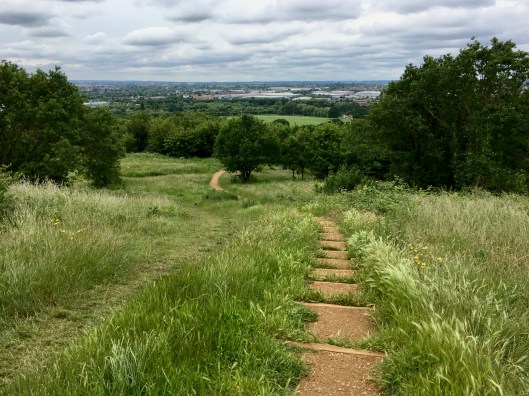
Horsenden Hill, broadly surrounded by Wembley, Alperton, Perivale and Greenford Green and with a hight of 276 feet, is the highest land and largest open space in the Borough of Ealing and provides one of the finest natural viewpoints in London. Settled 2500 years ago by Iron Age people whose pottery artefacts have been found in some numbers, it is now an English Heritage scheduled Ancient Monument.  During the First World War a horse-drawn anti-aircraft gun on the high-point offered protection against German airships. Today this wonderful green space of around 250 acres comprises areas of meadows, woodland, grassland and wetland attracting a wide variety of wildlife. This is the view from the summit. Home is out there somewhere.

IMG_5329.jpg

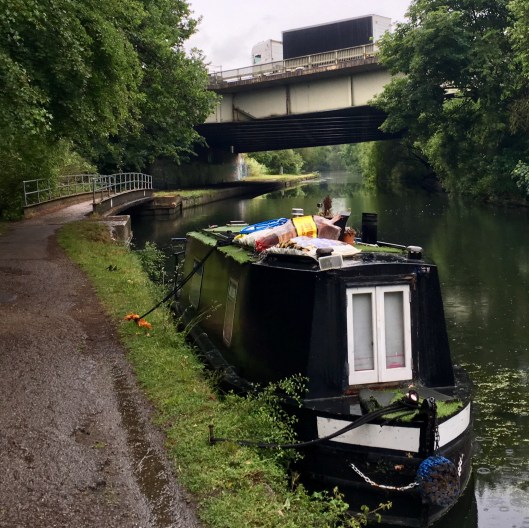
From Horsenden Hill there was a short walk along the towpath of the Grand Union Canal (Paddington Branch) which I recognised – just over 5 miles to push.

The final section of my walk started shortly after the Westway Shopping Park in Greenford. After skirting the Northolt Rugby Club ground and crossing the A40 I followed footpaths around Perivale Park. This is a very good facility for local people with its wide open spaces, football and cricket pitches and childrens’ playground. In the the context of my walk it was however unremarkable. What followed was not.

With a tingle of anticipation I walked through Brent Valley Park broadly following the River Brent. Being only a mile of so from my home I know this delightful park very well. It is a beautifully tranquil riverside park with meadows, extensive scattered trees. It houses Ealing cricket club and two golf courses, Brent Valley and West Middlesex. I have run and walked here, with friends, family and alone, many times. In my view it crowns many of the parks and green spaces travelled in the last 3 days and I was really pleased to be here.

IMG_5336.jpg

But there is a jewel in this crown. Adjacent to Brent Valley Park, formally entitled Brent Lodge Park, it was very fitting that my final significant green space on this walk would be the park that local people know very simply as Bunny Park. My pulse quickened.

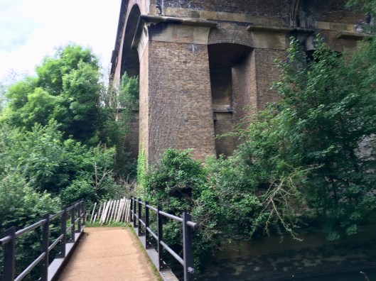
Still containing the River Brent this beautiful urban countryside park has extensive grassed areas and many trees along the riverside. There is a large maze with a raised viewing platform, there are two children’s playgrounds one including a death slide, or zipwire as I am often urged to term it before boosting the grandchildren along it. Every few minutes high-speed Great Western Main Line trains can be heard in the distance as they scream towards Paddington station over the Wharncliffe Viaduct. This viaduct was the first major structure designed by Isambard Kingdom Brunel. Built in 1837 it carries trains across the lower part of Bunny Park at a dizzying hight of 65 feet. But the occasional whoosh doesn’t detract from the pleasure given by this park. This really is the green green grass of home.

But the best thing of all is Hanwell Zoo, which is part of the park. Indeed some people think that the zoo is Bunny Park, but that’s not the case although there are rabbits in the zoo just after the entrance opposite the budgies. This little gem, open every day except Christmas Day from 10am and very reasonably priced, has recently been reinvigorated. It has a wide variety of exotic birds and small mammals including meerkats and lemurs, reptiles and butterflies and also has a sand play area. It is a really popular local attraction and after an hour or two you can relax in the lovely little cafe next door.

You will be waiting for the inevitable photos but I have to disappoint you, not out of carelessness but because I know they would be inadequate. Please go and see it when you are in the area – you won’t be disappointed. Or google Bunny Park Hanwell.

But I do have this for you. The view of the viaduct from almost under it, by a bridge that my family and I know as Pooh Sticks Bridge as we never fail to play pooh sticks with the youngsters as we pass over the River Brent.

IMG_5341.jpg

Following the Brent through the tunnel under the A4020 Uxbridge road, between the Viaduct Pub and Ealing Hospital, took me down the last few hundred yards of the river before it joins the Grand Union Canal in Hanwell.

IMG_5347.jpg
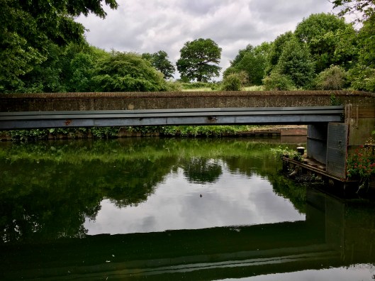
At the junction is part of the Hanwell Flight. This attractive flight of 7 locks joins the Grand Union Canal with the Thames. It has an end-to-end height difference of 53 feet over around a third of a mile. The scene was painted by JMW Turner around 1808. He called it, a little enigmatically given he must have know where he was but was working a few years before GPS-stamped photos, “A Windmill, Locks and a Bridge, Probably on the Grand Junction Canal at Hanwell.”

From the junction I turned left and my end-point was in sight; the footbridge over the little river offshoot that leads towards The Fox Inn and home. I term it the Fox Footbridge but there may be another name, or none at all. It was just starting to rain; rain that had been forecast for 11 am and mercifully hadn’t materialised.

IMG_5352.jpg

I last saw this little bridge shortly after 7:30 two days ago.

Since then I have walked 85 miles, a few longer than the official length of the Capital Ring due to some navigational challenges on day 1, over two and a half days. My step count was approaching 160,000 and with any luck I will have lost a pound or two, and I don’t just mean those spent in the Rusty Bucket on Monday or on the new shorts.

But my memories are not now, and I don’t think those that endure will be, about the distance, or the steps, or the pounds, or the increasing discomfort in my left calf or anything transient. It will likely be a far better and deeper understanding of how green London is. Look at the photos or, better still, walk a section or two. It really is very green, more than many people who perennially occupy cars and buses will appreciate.

The best section of all? That’s tough, because they were all completely brilliant, through the green spaces and the urban, the quietude and the noise, the rain and the sunshine. But I know the best of all was the green green grass of home. It was nearing home through Bunny Park. And the welcome at The Dodo, exactly on time, at 13:20 on Wednesday.

Thank you Hanwell. It’s good to be back.


The Capital Ring Day 2 – trains, planes and automobiles

13 Thursday Jun 2019

Posted by andyjameswriter in Walking London - the Capital Ring

≈ 4 Comments

Leaving my overnight B&B just before 7am I headed back to the Capital Ring route at the point I left it yesterday, on North Park. The target for today was Finsbury Park in Haringey, 25 miles away and a doddle after the 35 miles yesterday. Despite that I had left early to allow a more leisurely pace.

My wet gear hadn’t dried so my new shorts and other spare clothes were pressed into service. The wet stuff was tightly wrapped in a plastic bag at the bottom of my bag. The weather forecast for today was good – no actual sunshine but no rain either.  I’d had a light breakfast, had no injuries and no hangover so I could risk a broad grin as I set off east. Quite appropriate given Eltham was the birthplace of the great comedian Bob Hope. This might not be the Road to Utopia which Bob strode with Bing Crosby in 1946, but I could see it from here.

Putting nostalgia aside I set about the pavement work. There wasn’t much to note for the first hour except a small and seemingly unremarkable brick structure in the vicinity of Holy Trinity Church, known as Conduit Head. A very helpful notice nearby said it was part of the water supply system for Eltham Palace. It had probably been built in the early 1500’s by Henry VII when the palace was still a royal residence. I had passed Eltham Palace yesterday but for reasons you now understand I didn’t stop and couldn’t take a photograph.

IMG_5078.jpg

After that, Avery Hill Park proved to be a well-signed open park and once more the squirrels were around. I followed the route through the almost adjoining Eltham Park South before dodging commuter traffic as I crossed the thoughtfully named Rochester Way Relief Road, otherwise known as the A2. Safely on the northern side of the road I made my way through a series of wooded areas and meadows. This section of the walk, through or close to Falconwood, Shooters Hill, Charlton and Woolwich en route to the River Thames crossing, was among the most green so far. First were the Oxleas Woodlands comprising several individually-named woods or parks, including Eltham Park North. The Oxleas Woodlands, some of which are more than 8000 years only, contain some of the last remaining ancient woodland in London. Eltham Park North gave a wonderful view to the City between the trees across quiet green open space, and a helpful infographic…

 IMG_5087.jpg

… and it also also had a little lake, called Long Pond, which was home to several Canada geese and their goslings.IMG_5088.jpg

The Oxleas Wood Cafe was open and doing brisk business with the early dog walkers of which there were many and it commanded a fine view of the downs to the south. With blue sky and only a light breeze today was a significant improvement on yesterday.IMG_5093.jpg
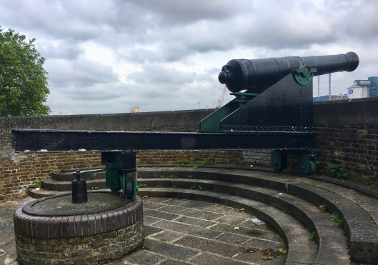
Skirting the Interserv Within Memorial Hospital via Jack Wood, Castle Wood and Eltham Common brought me to Shooters Hill at its junction with Academy Road. There was an ambulance on the junction and 2 motorcycles were riderless nearby. I expected their occupants were already on board and would soon be heading to the mercifully close Memorial hospital or maybe to the Queen Elizabeth Hospital also nearby.

Off Academy Road were more green spaces in succession: Woolwich Common, Hornfair Park and Charlton Park, all beautiful and fresh in the early sunshine. Emerging from Charlton Park I heard the sound of horses hooves on the road getting louder. This was a real treat. I don’t know whether they were simply exercising, or preparing their mounts for a ceremony but 20 or so uniformed soldiers, men and women were approaching along Charlton Park Road mounted on the most sleek and beautiful horses I have ever seen. Each rider was also leading one or two other unsaddled horses and I would estimate there to have been at least 40 of them and they were as magnificent as they were haughty and dignified. With a tingle down my spine I recognised the insignia on the riders’ uniforms as Royal Artillery. Putting two and two together I realised these were the mounts of the the King’s Troop, Royal Horse Artillery heading for their barracks in Woolwich, perhaps to take part in a significant ceremonial event later in the day. The King’s Troop are Her Majesty’s Mounted Ceremonial Battery and all its soldiers are trained to care for and drive teams of six horses pulling each of six First World War-era 13-pounder field guns used today to fire salutes on state occasions.IMG_5098.jpg

It was still only around 9:30 and I was making good progress. Once The Troop had passed I crossed the road north into Maryon Wilson Park, the last green space anticipated before reaching the Thames. Maryon Wilson Park, previously known as Hanging Wood,  was donated to the public by the Maryon-Wilson family in 1924. It was beautifully landscaped with well-signed routes, neat pathways and plenty of greenery. In addition to this it has an animal park with ducks, geese, pigs, goats, goats, peacocks, ponies that give rides to children, and a small herd of Fallow Deer too that are the decendents of those donated almost a century ago. The park is free and open 24/7. What a joy!

IMG_5105.jpg

After the peace of that park and the neighbouring Maryon Park it was back to pavements and traffic and noise. Espying the hoods of the Thames Barrier between warehouses and other commercial buildings I was directed to the east along main and minor roads to King Henry’s Wharf; a private housing development which nonetheless allows access to the river and the path.

IMG_5108.jpg

From here I could look back to the west. Three of the barrier’s hoods could be seen on the left with the high-rise of Canary Wharf beyond. I thought of my friends and colleagues hard at work over there, then turned to the east and walked on. To my left, over the river, was the huge Tate & Lyle complex, while ahead were new developments and the Woolwich Free Ferry plying its trade. Between these a yacht under motor chugged by, its white hull and elegant lines a contrast to its immediate surroundings.

Noting from a nearby sign, and not without a slight regret that I would shortly leave it, that the Thames Path would continue for 10 miles, my gaze turned to the cannons. Just ahead was a two-cannon gun battery built in 1847. Each massive gun was mounted on a track to enable rapid re-aiming should Tate & Lyle prove not to be a significant national threat after all.

IMG_5111.jpg

Further along the river, past where the Dame Vera Lynn was ferrying all traffic across the river for free I came to the Woolwich foot tunnel. Built well over a hundred years ago, in 1902, the 400 yard long tunnel is free to use and open 24/7. While lifts are available at both ends, those without buggies and other impediments may use the circular staircase. I counted 100 steps descending the southern shaft and 125 ascending on the north. In between it apparently takes 10 minutes to walk. When I was there it was pretty empty apart from one pedestrian and a couple of cyclists. Had they been going more slowly they may have seen the prominent ‘no cycling’ signs. However, in fairness to the wheeled ones, I see no reason why it shouldn’t be cycled with care. After all, I would have ignored a sign exhorting me to walk slowly. Ten minutes for 400 yards? C’mon!  Thankfully I saw no-one animal fouling, littering, loitering or spitting and those heinous buskers, skaters and skateboarders were absent too. It was just me and the pesky blind cyclists.IMG_5123.jpg

IMG_5124.jpg

Once topside, at what is nominally the end of the Capital Ring if you start at the beginning (the southern side of the foot tunnel) and walk clockwise to the end (the northern side of the foot tunnel) I was pleased to see the sun still shining and headed eastish. I say east-ish because due to some work being done the footpath was closed. There was no diversion but, now armed with a dry if water-stained map and fully recovered GPS it wasn’t too much of a struggle to find a way into Royal Victoria Gardens by road. This was another delightful little green space which in addition to the customary greenware (trees, bushes and grass) included tennis courts, ‘park gym’ equipment, and children’s play area and paddling pool and even several permanently fixed table tennis tables. This park was the first to have a river view though.

All too soon I was back on the pavement heading towards London City Airport, the proximity of which was becoming clear around every 5 minutes. Before the airport there was still time to enjoy views of there river, including via little slipways like this, the Bargehouse Causeway.

IMG_5137.jpg 
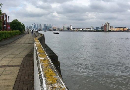
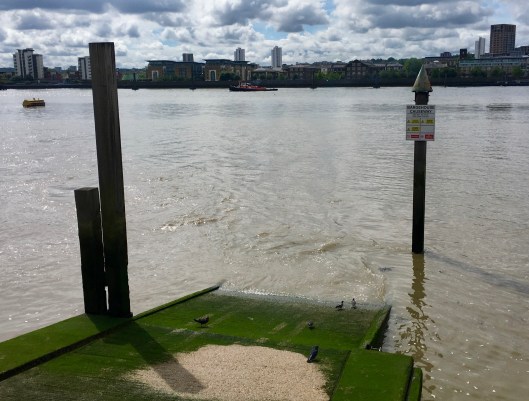
Then it was time to head back to the pavements. Heading up Barge House Road, traditional old terraced houses (street parking) on the left and newly built terraces  (garden parking) on the right the quietude was rent as a sky blue KLM jet took off almost overhead, presumably destined for Amsterdam. From here I was unable to find the riverside route to the Gallions Reach roundabout. Don’t be confused by the name conjuring visions of tall ships and billowing sails. Gallions Reach is a stretch of the river between Woolwich and Thamesmead, named for the Galyons, a 14th-century family who owned property around here, on both sides of the river. Instead I took the alternative, over the elegantly curved Sir Steve Redgrave bridge which spans 2 massive docks. King George V Dock, home to the Cunard liner RMS Mauretania in 1939, and the Royal Albert Dock, between which is London City Airport. The docks are now empty, I guess due to the security needs of the airport. While I watched from a vantage point on the northern side of Sir Steve’s bridge, 2 British Airways jets landed from the west and, although undoubtedly noisy, the BA jet that took off was an impressive sight, Royal Albert Dock in the foreground of this photo.

IMG_5151.jpg 
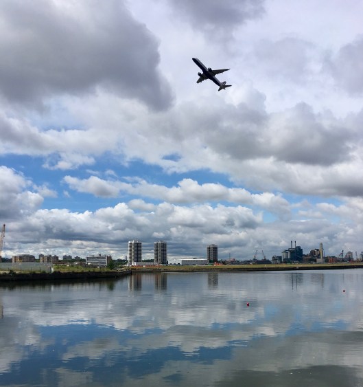
Then I was in for a pleasant surprise. The northern bank of the Royal Albert Dock is home to the University of East London and its colourful white and turquoise accommodation blocks. Beyond these modern buildings are new roads and amenities in the developed areas of Cyprus, Custom House and Beckton, and a sequence of green spaces. The route passes through New Beckton Park and Beckton District Park complete with sizeable lake, and close by King George V Park, all bright and open with space to play, read, walk, learn, exercise and generally try to ignore the occasional airport noise. I was impressed. Even the dumped shopping trolley was green! I include this tongue in cheek. In fact, this was the only dumped trolley I saw and, by and large, these parks were clean and litter free and had a distinctly community feel.

IMG_5154.jpg

Then I was in for another surprise. You may be sensing a theme that East London, at least the area I saw, was not as expected.

When crossing the A13, called the much more community-oriented Newham Way in this part of town, with noise reducing screens and a cycle path added, I espied a junction signpost headed ‘Beckton Alps’. Investigation revealed that to be the name given to the toxic spoil heap left over from the now-defunct Beckton Gas Works, now the highest point in Newham. Some bright spark decided to memorialise that in the name of the A13/A117 junction. In derision and to make a point, local people call it Beckton Alp (singular). Just after crossing the A13, I saw a sign I just have to share with you as it was on the route and I found it hilarious. I think it needs no explanation…

IMG_5159.jpg

Anyway, back to the positives. The surprise I alluded to was the Greenway. Only a few yards from where the last picture was taken the Capital Ring joins for around 3 miles, a 6 mile long raised footpath and bike freeway between Beckton and Stratford. Initially known locally as Sewerbank as it followed the top of the embankment of Thames Water’s northern outfall sewer, it was fully renovated in the mid-nineties and recent work has resurfaced and renovated the route with gates, ramps, stairs and signs. Once more I was impressed. There is the inevitable litter along the route, but in fairness, not much and it was sweet wrappers and crisp bags as much as beer cans. Even the limited graffiti was colourful and artistic. 

IMG_5163.jpg

The community orchard is coming along nicely and runs for several hundred years on the southern side of the Greenway at the Beckton end. The photo below is only a snapshot. There were locally-made signs encouraging a community spirit saying: “Enjoy the space … feel free to pick and harvest crops … but just a little bit … leave plenty for others 😀”. The notice in the picture below advertises a ‘Green Gym’ every Thursday from 11am to 2pm. It offers the opportunity to develop confidence and group skills in a friendly and informal group planting, pruning, maintaining, building, weeding, planning and harvesting. Seeing this I was uplifted as I sped by East Ham, Upton and West Ham and Plaistow.IMG_5167.jpg

One of the best things about being on an elevated path is uninterrupted views. Those across the rooftops of East London were fascinating, while those to Canary Wharf in the south were stunning and the evidence of many parks and playgrounds were there to see. Although the view of ‘Waterworks River’ at low ebb was unedifying…

IMG_5170.jpg

… the palatial and elegant Abbey Mills Pumping Station was a beauty.

IMG_5172.jpg

On Stratford High Street, which the Greenway, and the Capital Ring, crosses a few hundred yards after the pumping station, the Greenway normally continues directly across the road. At the moment there are works afoot which forces a diversion. This was made clear on the excellent TFL Capital Ring website but I could see no diversion or sign indicating the alternative route on site. All I could see was this, blocking the route. The bugs and butterflies were cute but no help if you hadn’t checked beforehand.

IMG_5173.jpg

However, I had checked so disappeared down the road and through an industrial site, by the Pudding Mill Lane DLR station. I reappeared up the bank onto the route to be faced with the Queen Elizabeth Olympic Park, especially the magnificent ArcelorMittal Orbit (the big red helter skelter) and the London Stadium, now the home of West Ham FC.

IMG_5183.jpg

From the olympic park it was a few strides on the Greenway to my turn-off point, onto the River Lea at Hackney Wick by the Old Ford Lock. Talk about different. In a few yards (ok a hundred or so) I had gone from the openness and modernity of the olympic park to an eclectic canal-side scene and community. Anyone familiar with breakfast TV may have recognised the Lock Keeper’s Cottage as the setting for the Big Breakfast Show until it ended in 2002. For the first few hundred yards the right and bank was lined with a varied collection of river craft, some neat and some less so, while the other bank was more commercial.

IMG_5191.jpg

Further on, with the Hackney Marshes on the right, warehouses were more in evidence on the left and there were fewer craft.IMG_5192.jpg

Further still the character turned more colourful and bohemian. I snapped a quick photo and didn’t linger.

IMG_5197.jpg

Eventually the scene returned to that of any canal in the country. A meandering waterway with occasional moored craft and various styles of buildings periodically looking on. There were occasional waterside pubs offering food and drink but, amazingly, I resisted suspecting that getting up again would be tougher than sitting down.

Where the modern world was less intrusive I saw a cormorant dive into the water and emerge with a fish, position it correctly while it was still thrashing, then eat it in a single gulp. In the same area a squadron of swallows were diving and weaving for flying insects, possibly dragonflies as these were abundant. I tried to get photos but the cormorant and the swallows were too quick. Instead I snapped a pair of swans with their cygnets.

IMG_5212.jpg

At the Horse Shoe Bridge my route turned into park and woodland in Stamford Hill’s Springfield Park. The park was typically green and well tended with woodlands and open spaces but also had a great little pond with ducks. You’ve seen enough photos of this type of park so I won’t trouble you with another. But it was a lovely park nonetheless and was being well used this lunchtime.

The subsequent walk through the streets of Stamford Hill was an education. I suspect the area is popular with Hasidic Jews given the preponderance of their traditional clothing and hair style here.

Close to Stoke Newington train station I commenced the final leg for today, via the distinctly gothic and fascinating Abney Park Cemetery. Abney is one of the ‘Magnificent Seven’ garden cemeteries of London, being a woodland memorial park and Local Nature Reserve too. As I walked through this wonderland the words ‘don’t blink’ were uppermost in my mind.

IMG_5218.jpg

Clissold Park followed, and it was fine, but I was feeling a bit ‘parked-out’ for the day. Equally the East and West Reservoirs between Stamford Hill and Finsbury Park were vibrant with little yachts being thrown about by enthusiastic youngsters and canoeists doing their thing. It was all completely wonderful but I think I had just had enough green for one day. These little creatures summed it up for me nicely.

IMG_5229.jpgMy B&B on Green Lanes beckoned. I was ready for a sit down refreshment (beer rather than another draw from the bladder of orange squash in my rucksack), and some food. My bowl of muesli and orange juice in Eltham at 6:30 this morning seemed a long time ago. Actually it wasn’t that long ago as it was still mid-afternoon, but it was 26 miles and over 51,000 steps behind me.

The two-day total is 60 miles and 116,000 steps and I’m beginning to feel them all. But what fun!

If you’ve made it this far thank you so much. Hopefully I’ll see you tomorrow for the final leg.


The Capital Ring. Day 1 – the day of the deluge

12 Wednesday Jun 2019

Posted by andyjameswriter in Walking London - the Capital Ring

≈ 10 Comments

Seven twenty three on Monday morning saw me leaving home in a light shower. It got worse.

I had a waterproof in the rucksack but didn’t wear it as it was only a shower. At the last minute I had jettisoned my waterproof trousers as (1) I didn’t think the weather forecast warranted the extra weight, (2) I didn’t really want to do 35 miles with plastic bags on my legs and (3) I’m waterproof. So it was that in trail shoes, shorts, my favourite red trekking t-shirt, a waterproof peaked cap and with Terry towelling wristbands to keep my blood warm at the wrist and keep my Fitbit watch in place I set of for the Dodo in order to leave there at 7:30. My bag contained, all in drybags, a minimalist wash kit, waterproof jacket, fleece, spare t-shirt, handkerchief and underwear, a few folds of loo paper, spare battery and the cables to charge phone, battery and watch, Swiss Army knife, some plasters and antiseptic cream, contact lenses, a bag of trail mix and 2 litres of water. I thought that was fair for a stroll around London even if it was going to rain a bit. I had around 35 miles to cover and assuming an average of 4mph, that start time would see me at the Rusty Bucket, a micropub in Eltham, at it’s 4pm opening time. Passing The Fox at some speed I joined the Capital Ring route on the canal spot on time. It was still drizzling but I generate a lot of heat and my t-shirt remained comfortable. My Rab event breathable waterproof remained in the bag. It’s really very breathable but not completely so and I really didn’t want to wear it as it can get a bit clammy on my skin. I also decided to keep my glasses on rather than wearing contacts on day 1. It’s not tricky underfoot so the varifocal discontinuity wouldn’t be the issue it was in Corsica, and I wanted to be able to read my paper maps and ViewRanger nav aids without having to plonk reading specs on my face every time.

Osterley Lock, the end of Capital Ring Section 7, was passed on schedule at 7:55. Section 7 starts at Richmond if you are walking The Ring clockwise as it is written. I was doing it the other way so would be walking to Richmond, 5 miles distant, with a target time of 9:10. I was walking counter clockwise so I could finish Monday with a beer at Eltham’s Rusty Bucket, as mentioned in the last blog, and as The Dodo is closed on Monday’s it opened an opportunity for others to visit the Rusty Bucket as we had spoken of doing. I explain this only so you get the logic of deliberately walking a route when all the route guidance and instruction are written to in the other direction. You can see in the picture that the canal is being liberally dappled by raindrops. It wasn’t slackening off.

From here the deafening roar of the M4 is normally a blight but today it being Monday morning, traffic was crawling. Annoyance at the noise was instead replaced by distaste of the smell of fumes that cascade down from the flyover unseen. Shortly afterwards the bumperty-bump of the Piccadilly Line tube rattling over the girder bridge returned the customary racket, followed by the truck gears grinding in the waste tip alongside the canal and more noise and fumes from the A4. Such is the serenity (not) of the Grand Union Canal in our neck of the woods.

But at least we have a canal and the swans, coots and moorhens don’t seem to mind. I even saw the stately heron.

After passing Heron’s Reach and a short stretch of the A315 as it delivers commuters into London past Majestic Wines and Pets at Home, I turned into Syon Park. While it’s grounds, rather grandly given it is 12 miles from central London, host the ‘London Hilton’ the park itself is home to a very good garden and aquatics centre and Syon House.

This pile and its 200-acre (80 hectare) park belongs to the Duke of Northumberland and is his family’s London residence. The house was built in the sixteenth century on the site of the Medieval Syon Abbey, and came to the family of the present owners in 1594. On this occasion ignoring the very grand Great Conservatory and Pavilion summer house by the river I pressed on to the bank of the River Thames in Isleworth, on the opposite side of the river to Kew Gardens. Passing the London Apprentice pub, apparently the place to which apprentices were rowed from the city to celebrate the completion of their apprenticeships, this establishment has another historical reference. The pub overlooks Isleworth Stairs, established in the reign of Henry VIII for the Richmond Palace ferry to take him to the north bank of the Thames. It was from here that the Nine Day Queen, Lady Jane Grey, boarded the Royal Barge on 9 July 1553 to accept the throne as Queen of England, only to be imprisoned in the Tower 9 days later.

Moving south through old Isleworth and approaching St Margarets the intensity of the rain ratcheted up a bit. I still didn’t put my waterproof on; it wasn’t that bad and, anyway, I was already fairly damp but it was now very wet underfoot and the city gents en route to the station were all fully mac’d up and wielding infeasibly large brollies. I laughed at them quietly but then crossing the Thames via the footbridge over Richmond lock I discovered a shortcoming in my footwear. First class on dry stuff and wet stuff with some knobbly bits for the tread to grip onto, but not polished steps. Going up the steps to the gantry wasn’t a problem but I slipped down several on the other side. A lady runner was climbing gingerly up as I careened past. Thankfully I had my hand on the rail and disaster was averted. “Wow, that’s a bit slippy” I quipped breezily. “It certainly is – I’ve seen worse slips” she agreed gamely. Note to self – don’t assume these otherwise brilliant Adidas trail shoes will make up for route complacency. That matter was to return with a more undignified outcome.

Still the rain was persisting down. The beggar under the rail bridge took one look as I passed and didn’t even bother to beg. He just nodded, presumably in sympathy as he was at least dry.

Richmond itself looked splendid, the grand riverside buildings now shimmering in the rain as I passed, head down, unsure whether to admire the architecture…

… or pity the coxed eights being blasted down river by their coach in a speedboat.

South of the town and the line of fume vomiting cars queueing by Lansdowne Terrace I moved away from the river into more open ground, noting that even the cows from Petersham Farm had forsaken fresh grass for cover. Were they trying to tell me something?

It was too late now. I was pretty wet but moving fast and keeping warm with the magnificent Richmond Park coming next.

I entered the park by The Dysart and the Petersham pedestrian gate and headed uphill fast with my go-faster poles, smug that the guys running behind me and declaring just a little too gleefully that they should ‘catch the guy walking’, didn’t. Once on the top, the normally stupendous views over London were greyed out, and the herd of 600 or so Red and Fallow Deer were too smart to be out in this weather, but the ducks on the pen ponds were enjoying it.

After leaving via the Robin Hood Gate next to the Stag Lodge stables, crossing the mad A3 and passing the lush playing fields of Kingston University’s Roehampton campus I was straight onto Wimbledon Common. Whether all the squirrels had been flooded out I don’t know but I don’t believe I have ever seen so many squirrels. I tried to take a photo but my iPhone was beginning to play up a bit. My shorts were now wet and so the phone in my pocket was too. My hanky was still only damp but by the time I had dried the phone screen, and realised my finger was too wet to be recognised and tapped in the pass code, the sneaky blighters had scarpered.

Unsurprisingly there were no golfers on the course, only several dozen dog walkers and their charges, and each person was determinedly cheerful. After all, it was only a bit of rain and it wouldn’t last all day would it? Maybe not but The Windmill Tearoom by the car park was doing a brisk trade.

Next up, having been required to do a bit of pavement work and once again, this time on the steeply sloped Somerset Road which I mused should be called Summersgone Road, I actually slipped the length of a metal manhole cover. It was only 2 feet or so but it was another warning. Mercifully I didn’t hit the deck but that would have been seemly in such close proximity to The All England Lawn Tennis and Croquet Club, i.e. ‘Wimbledon’, the scene of many a slip up in the past as top seeds were upended.

Nonetheless within 10 minutes walk I was in Wimbledon Park. While the grounds are extensive and well maintained it was the lake that drew my eye. There were several sailers under instruction, several boats full of schoolchildren, boys and girls, having a whale of a time playing some kind of floating murder-ball, and sitting above it all was a swan and her cygnets.

Then I stumbled upon the Waterfall Garden designed, as was the rest of the park, by Capability Brown.

Things went a bit downhill after this. Previously, as you have now read, it was park after park but now there was a lot of road work. That doesn’t make it bad or boring, rather I had been spoiled ever since Osterley Lock.

Nevertheless in amongst the pavements I found the magnificent and very large Wandsworth Cemetery (in Earlsfield), Wandsworth Common and Tooting Bec Common. Regrettably in the middle of these was Wandsworth Prison and Balham.

The parks were extensive and beautiful, even in the rain. Unfortunately I was hardly able to take photos any more as my camera phone was too wet. I was even having to wring out my hanky before wiping the screen and I had nothing with which to dry my hands even on the few occasions I got the phone to wake up. I do have this one though, of 2 happy ducks on the pond in Wandsworth Common.

That’s it i’m afraid. There are no more photos. I was half way with around 16 miles done and 16 more to do. At my speed that’s about 4 hours. You’ll just need to imagine the next bit.

As I was approaching Streatham Common the heavens opened. I was soaked through. Even more than I was before. People around me were running for cover but there was none, other than trees, and there was a rumble or two of thunder! There was nothing I could do but try to make progress. It still wasn’t cold and I couldn’t get any wetter. My paper map was sodden and unreadable. The phone was unusable and, I knew, very low on battery. Then towards the top of the common on the road to my right, a Godsend appeared. At the top end of Streatham Common South Rd., just past Covington Way on the right: The Rookery Cafe. It was quite full of course but I found a small table among some odd looks, me being in a t-shirt and shorts. I just dropped into the floor and had a black coffee and a chocolate cookie. Eventually I switched on and used the napkin to dry my phone and to my joy found the spare battery was still dry in my rucksack so plugged in in to try to breathe life into the phone. I figured I’d better have another coffee to eke out my time. I really wanted to wear my contact lenses instead of glasses as they were rain spattered and constantly steaming up but I would have to use the readers so I would be no better off and with worse vision. So, tempted though I was to stay longer I had a deadline to keep and I don’t give up easy.

After 30 minutes and with a bit of power in the phone (crazily I hadn’t thought to plug it into a socket!) I put my bag on my back, my wet hat on my head, and walked out into the deluge.

I was now 30 minutes behind schedule, feeling a bit chilly but ok, with no reliable navigation aids, reliant entirely on the Capital Ring waymarking, some of which were hard to see being green among trees and bushes and being viewed through wet and steamed glasses. Some I had seen to have been tampered with. You know, for a laugh. I’d had to check and correct them on a map.

But it was that or go home. This was now a personal challenge!

So I ran. No uphill but all the downhills and much of the flat. I ran to keep warm and to make up time, and to make up for the inevitable route errors I would make. I ran to keep my spirits up, to be doing something positive. Something other than shivering on bus fretting that I was letting people down.

I was already towards the top of Streatham Common so I ran down to Norwood Common. I got lost in Biggin Wood but had just enough print on the map to see roughy where the route went so I returned to Norbury Hill and picked up the route again on Beulah Hill. The signing was good through the rest of Norwood so I was able to follow. The running was going well too. Last weekend in the Lake District I had seen a fell runner running with poles and I copied his style. It’s fine as long as you have very lightweight poles, which I do. The worst thing was the additional effort of running was making my specs steam up. Well, at least I was warm.

Crystal Palace started badly, got better, then I came a cropper. I found the football stadium ok as it was hard to miss, but then I couldn’t find where to go after. The paper map was useless in that area and I went a long way out of my way before realising and going back to the stadium. Luckily there was a bridge under which there was some litter rubbish, including some tissue. Don’t ask! But at least it had dried and I was able to dry the phone and a finger to stab it with. Result! I now knew where to go and found the lost route. It was a mapping inconsistency. The paper map, though sodden, showed the route clockwise round the studio while the ViewRanger route went the other way. I still don’t know which was right but I knew where to end up, straight down the Grand Centre Walk. It was mostly downhill and I was on a roll. I played the same trick with discarded tissue at the railway bridge by Penge West station. Over the road and down the hill; second left. But before I got to the second left I slipped on a metal manhole cover and went down. Thankfully my foot slipped forward so I went down on my back, which was protected by the rucksack. No harm was done and, although the rain had eased a little, the streets were still quiet. So, jump up and go on. Carefully!

Then came Sydenham and New Beckenham. Both were ok with good signage. But it went horrible in Beckenham. Firstly I followed Capital Ring sign to Beckenham junction station. It was a valid sign if you were ending the walk at Beckenham and needed the train or tram station. It indicated right at the top of Stumps Hill Lane and I followed it all the way. That was a kilometre in the wrong direction. My route was left at the top of Stumps Hill Lane. It took me quite a few minutes to work out what I’d done wrong. All I knew was that the signs stopped at Beckenham Junction. I tried desperately to get some life from the phone, constantly drying it as best I could and trying to dry my finger in the underside of the rucksack strap. Then I got lucky. For some reason the phone worked and I was able to tap in the code. All became clear and I tried to memorise as much of the next few moves as possible then ran back to where the error had occurred. Just beyond that I turned into Beckenham Place Park and things went wrong again.

There were some works being done on the roads around Beckenham Place Mansion and to my horror I espied this. I know I said there were no more photos but I saved this blurry treat which somehow I managed to take. There I was, with no maps worth looking at, a phone that would only work fleetingly if dry and I had nothing dry to use other than my spare clothes, and trying to see through smeared and steamed-up glasses. I was totally reliant on signage, and to my right, this is what I saw:

Some selfish imbecile had thrown the sign on the ground. I could have cried. I tried the phone again but it was dead. Then I played my last card and got lucky. I remembered from the snatched view in Beckenham that the route was complex through the park but it emerged on a road to the north east. Maybe if I went back to the road, turned right down the hill and went over the railway line, then took the first decent right turn and kept going maybe I would bisect the route at a signed junction. If I didn’t find it the game was over. But it was there. I was speechless and very relieved.

And that was the last problem I had. There were still several miles to go but the rain was less torrential and the signage was good. The route through Downham Woodland was good and even though it was uphill I kept running. From joy probably. Grove Park was also easy to follow and that was the end of the section. All I had to cover now was 2 miles or so through Mottingham and Eltham Palace.

I checked the phone and it kindly told me the time. To my astonishment it was 3:15 and I was ahead of schedule. I had 45 minutes to do 2 miles.

I arrived at Eltham’s Court Road at 3:45 and decided to do some of tomorrow’s route today. I didn’t want to be sitting on the Rusty Bucket’s doorstep dripping so I went along North Park and turned left into Passey Place and followed it to Eltham High Street. In front of me, slightly to the right was Marks and Spencer’s and it was 9 minutes to 4.

You can guess the rest. I knew exactly what I needed. Dry shorts. I had everything else in my bag, but there were no shorts.

Five minutes later I had them in the bag, much to the amusement of the shop assistant who suggested I put them on there and then. But I had a deadline to meet.

It was off at the trot, down the High Street to Court Yard, turn left and go past Wetherspoons to the Rusty Bucket.

I practically fell through the door at exactly, and I mean exactly, 4pm.

That was quite an adventure. From inside my soggy shoes it was an epic. I couldn’t recommend it. But I’m so glad it happened and that you came with me.

Oh, you want to know about the evening?

Well dear Lucy, proprietor of our beloved Dodo had travelled nearly 2 hours to get to the Rusty Bucket and have a drink or two with me but far more importantly with Rachel and Stuart, co-proprietors of the Rusty Bucket. Presumably through some 6th sense Lucy arrived about 4:05 which gave me time to change and we proceeded to sample some fine ales in cask, keg and bottle. We laughed a great deal with Rachel and Stuart, bought some t-shirts, met 2 chaps who are in the final throes of buying a micropub and among others were were entertained by a lady who writes satirical material for the BBC. She asked us for inspiration but the best we could manage was irony, which apparently isn’t quite the same. I guess that’s why she works for the BBC and I write a blog.

After a while I was getting a bit worried that my B&B owner would be concerned that I hadn’t shown up when I said I would and it was now after 7pm. I was just drafting a grovelingly apologetic email with a promise to be there soon when he phoned me. He was very sorry but he had to go out for a while. He asked me if I would mind delaying my arrival until after 9:15. Result!

After a good start and end but a distinctly wobbly middle, Day 1 on the Capital Ring turned out all right didn’t it?

A circumnavigation of London – the Capital Ringz

05 Wednesday Jun 2019

Posted by andyjameswriter in Walking London - the Capital Ring

≈ 2 Comments

The Capital Ring is a signposted circular walk of 78 miles (126km) around London. Divided into 15 ‘easy-to-walk’ sections it traverses some of London’s finest scenery, including open spaces, fine scenery, nature reserves and Sites of Special Scientific Interest as well as urban areas. The graphic below, courtesy of Transport for London’s very helpful and informative website, gives the general idea.

capital-ring-and-logo.jpg

Over two and a half days commencing Monday 10th June I will walk the Capital Ring, counter clockwise, starting and finishing at The Dodo Micropub in Hanwell. The Dodo is close to Section 7 of the walk and while it won’t be open when I start, at 7:30 Monday morning, it will be open when I return around 13:30 Wednesday and I can’t think of a more fitting place to finish my walk. The Dodo’s fine ales and one of Mr Barrick’s legendary pork pies will encourage a timely return.

On Monday I will walk over 30 miles from The Dodo in Hanwell to The Rusty Bucket in Eltham. Why? Because many months ago I met Rachel, now co-proprietor of this wonderful micropub, in The Dodo when she popped in for a chat and left inspired. Those of us who met her said we would visit once the Rusty Bucket was up and running. And it’s time we did. I plan to be there at opening time at 4pm having left The Dodo at 7:30. This day will see me walk through or around Brentford, Richmond Park, Wimbledon Common, Wandsworth Common, Streatham Park, Norwood, Beckenham and Crystal Palace to Eltham.

On Tuesday I will walk from Eltham via Falconwood, the Woolwich Foot Tunnel, London City Airport, the Olympic Park, Hackney and the River Lea to Finsbury Park and on Wednesday I will start early, around 7am, in order to enjoy an ale and pork pie at the Dodo, all things being equal, by around 1:30. My route in the final day will be via Highgate, East Finchley, Hendon, Harrow and Greenford.

Should anyone want to join me for a section or two on my fairly sprightly trip around some of London’s finest scenery please let me know and I’ll share the section timings. Or maybe you fancy a visit to The Rusty Bucket? Otherwise I hope you will enjoy the blog which will aim to take you with me in words and pictures.

Enter your email address to subscribe to this blog and receive notifications of new posts by email.

Join 105 other subscribers
Follow Andy James on WordPress.com

Blog Archive Categories

  • Dolpo trek (45)
  • Lefkas (3)
  • Mont Blanc June 2019 (8)
  • The Great Glen Way (6)
  • The Haute Route (10)
  • The West Highland Way (6)
  • The Writing Journal (6)
  • Walking London – the Capital Ring (4)

Blog at WordPress.com.

  • Follow Following
    • Andy James
    • Join 47 other followers
    • Already have a WordPress.com account? Log in now.
    • Andy James
    • Customize
    • Follow Following
    • Sign up
    • Log in
    • Report this content
    • View site in Reader
    • Manage subscriptions
    • Collapse this bar
 

Loading Comments...