
Hi everyone,
Two months have passed sinse I was last in the Alps and the old feet are getting restless. But the itchiness won’t last for for long as I’m off again tomorrow and for once I won’t be climbing but walking and the views will be green rather than white.
A group of friends and I, led by the fantastic guide and good buddy Pascal Rolle, are currently heading for France and are going to walk the Alpine Haute Route (or the High Route or the Mountaineers’ Route).
First identified as a summer Alpine mountaineering route by the English Alpine Club over 150 years ago, it normally takes around 12 days to walk (or 7 days to ski) the 180 km from the Chamonix valley, where I stayed prior to climbing Mont Blanc in June, to Zermatt, home of the Matterhorn. There isn’t a fixed route and depending on the conditions day by day some sections of glacier may need to be avoided by those not geared up for glacier travel. However, we will try to stick as close to the original route as possible, and will do it 10 days. Now there’s a surprise…
I believe that for some of the time we will be on the “Walker’s” Haute Route, which is an alpine hiking trail that follows a network of well-marked and signposted paths. The “Walker’s” route stays below 3000 meters and takes advantage of the popular mountain huts and small inns and hotels in the villages along the way. Sounds good eh? In the spring, summer and fall, this route is safe and requires no ropes, crampons, or protection devices but remains challenging because of its daily elevation gains and distances.
Whichever way we go, the Haute Route in 10 days (actually nine and a half as we finish in Zermatt early in the afternoon of day ten), will be a wonderful leg-stretch in glorious mountain scenery and I am looking forward to taking you with me.
I shall try to post a blog every day, but that will depend on phone coverage (likely to be spartan in the valleys and more remote areas) and the availability of Wi-Fi in the evenings.
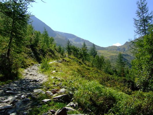
All things being equal, my next post will be tomorrow from the village of Trient, just over the border into Switzerland, in the canton of Valais. We will get there via the Col de Balme (the Balme Pass). The col is at 2195m (7201ft) and we will climb nearly 900m (nearly 3000ft) to reach it before descending almost but not quite as far to the village in the valley beyond. As a ‘taster’ this is what it should look like in the pass (courtesy of Wikipedia).
More tomorrow. Hopefully…

Looking forward to hearing more! Enjoy the ‘leg stretch’!!!!! xx
LikeLiked by 1 person
Looking forward to joining you all “virtually”! Bonne chance!
LikeLike
Thanks Alia and Nick. We know you’ll be with us in spirit 😀
LikeLike