• About
  • Photographs
    • In Praise of Agiofili Beach
    • Corfu’s Most Beautiful Village?
    • Making a splash in Vassiliki

Andy James

~ A Writers Journey

Andy James

Category Archives: Dolpo trek

Getting to the start line

12 Wednesday Oct 2016

Posted by andyjameswriter in Dolpo trek

≈ 2 Comments

Hi everyone. In this post I’ll try to paint a picture of the first few days, from arrival in Kathmandu to departure from Jomsom.

These 3 days will begin with frantic last-minute sorting-out, the purpose of which will hopefully become clear in later posts. We then have a 2-stage transfer from the delicious madness and furore of Kathmandu to what I am increasingly coming to think of as ‘the frontier’ at Jomsom via Pokhara. From Jomson we step into the outback.

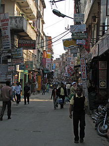
Tue 1 Nov. Following an overnight flight from London and a short flight-change at Delhi I should arrive at Kathmandu’s Tribhuvan airport at 14:15 Nepal time. By then the clocks at home will have ‘fallen’ back an hour so I think I will land 5hrs 45mins ahead of UK at the time I would otherwise be joining the rush hour on London’s tube network – 08:30. With any luck my bags will appear without too much delay and I will be on my way to Thamel, the most fun and interesting part of Kathmandu in my view. Thamel is the centre of the tourist district and is a commercial area with myriad shops selling everything an ill-prepared trekker might need. Hopefully this particular trekker will not be ill-prepared but there is always something that is remembered just after you leave home on a trip. At least that is my experience. The picture below shows Thamel as I have never seen it. It is normally rammed with colourful people, cars, motorcycles, bicycles and cattle all vying for space in a maelstrom of magnificent bustle and it’s accompanying cacophony. I can only assume this photo was taken very early in the morning. I will join the throng to acquire several known must-have’s. A tent for one – lightweight essential! A local SIM card for my iPhone. A selection of boiled sweets, dried fruit, nuts and chocolate bars with which to keep the digestive fire stoked if rations run low or prove unpalatiable in the depths of altitude sickness. Finally I need a stove and fuel on which to cook – a skill which has largely escaped me hitherto but which I had better learn quickly. Doubtless I will be temped by other goodies such as the socks I should have packed but didn’t or a jacket to replace the wonderful Rab Lite Alpine softshell I left on the plane. Yep – been there! Finally I suspect a burger and chips and a beer or two at the Northfield Cafe and Jesse James Bar might be necessary. It would be churlish to pass it by I am a fan of Pete McCarthy’s edict coined during his excellent and hilarious book ‘A Journey of Discovery in Ireland’: “never pass a pub with your name on it’! Tim also recommends Sam’s Bar in Thamel. While neither of us are called ‘Sam’ I could make an exception…

Good times aside an early night will be required as it will have been a long day and we have an early start the following day when we transfer to Pokhara.

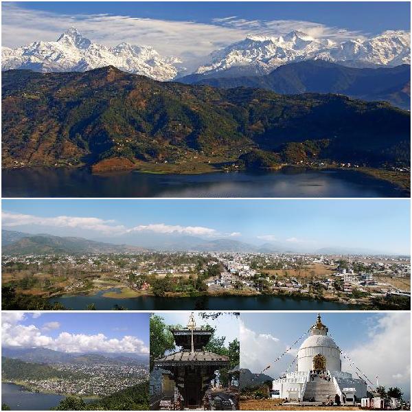
Wed 2 Nov. It is not possible to fly direct from Kathmandu to Jomsom and the overland journey would take too long. Our sherpa support team will travel overland as they will have had longer to prepare and, frankly, are more used to the driving in these parts which may be best described as a bit of a lottery. From the safety of a side alley the fact that drivers use their horns as a kind of ‘language of the road’ seemingly being conducted as a symphony by the smartly turned-out but largely ignored traffic police may be fun to see. Being part of it would require a degree of understanding unlikely to be gained after an afternoon in Thamel. What is more towards Jomsom the road is prone to landslides and flooding, so we Western newbies will fly, via Pokhara. That is a most agreeable option as Pokhara, Nepal’s second city and located 125 miles west of Kathmandu, is a gem. I have never been, but Lonely Planet says of Pokhara: “Far from the earthquake epicenter, and almost unaffected by the disaster, Pokhara ticks all the right boxes, with spectacular scenery, adventure activities, and accommodation and food choices galore. Whether you’ve returned from a three-week trek or endured a bus trip from hell, Lakeside Pokhara is the perfect place to recharge your batteries. The scene is a chilled-out version of Thamel, stretching along the shore of a tranquil lake with bobbing paddle boats. From the lake, and possibly even from your hotel bed, you can enjoy a clear view of the snow-capped mountains, just twenty or so kilometres away.” Well, maybe we won’t have a chance to experience all of that – we’re only there for 1 night. But we can try! The photo montage below from Wikimedia shows Top: View of the Annapurna Range from Pokhara; Center: Panorama of Pokhara; Bottom from left: Pokhara Valley, the Talbarahi Mandir in Phewa Tal, World Peace Pagoda in Pokhara

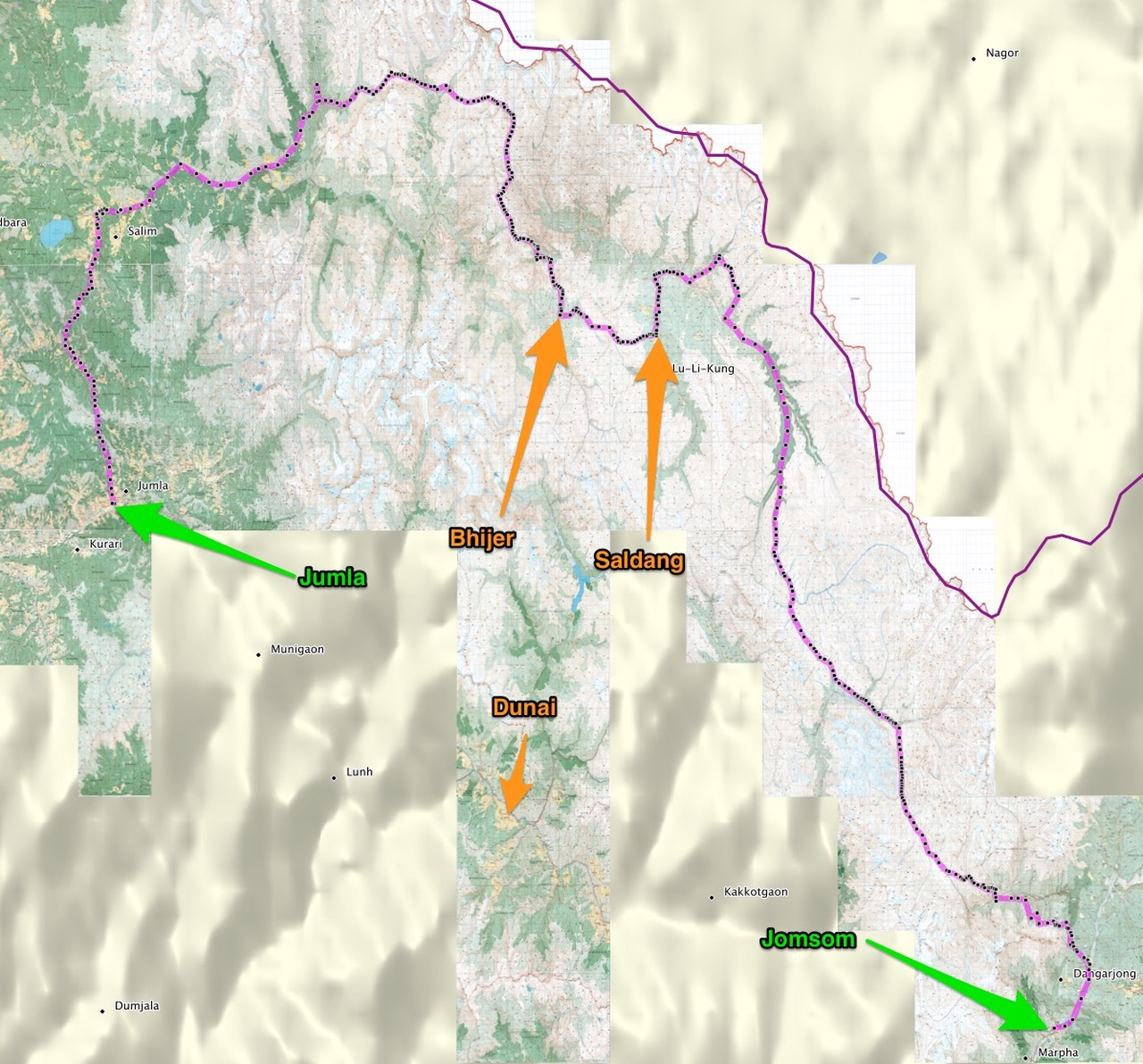
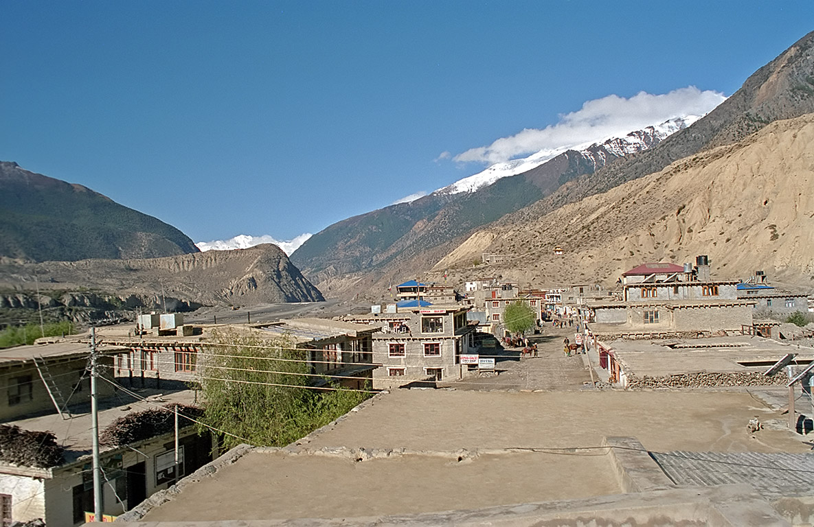
Wed 3 Nov. Today we say farewell to the glorious Pokhara and head to Jomsom on the one-a-day plane. Also known as Dzong-Sampa or New Fort, Jomsom is a compact small town (some might call it a large village) located at an altitude of about 2700m in the Annapurna mountains. It extends over both the banks of the Kali Gandaki River and is a useful final staging post by air. The picture below is of Jomsom airfield.

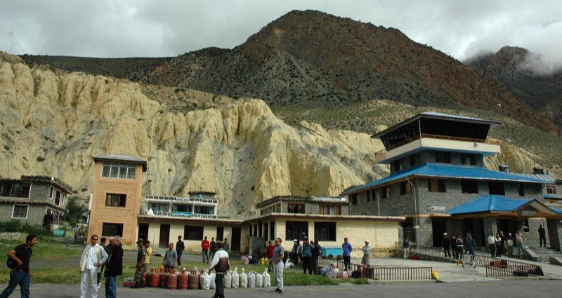
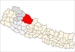
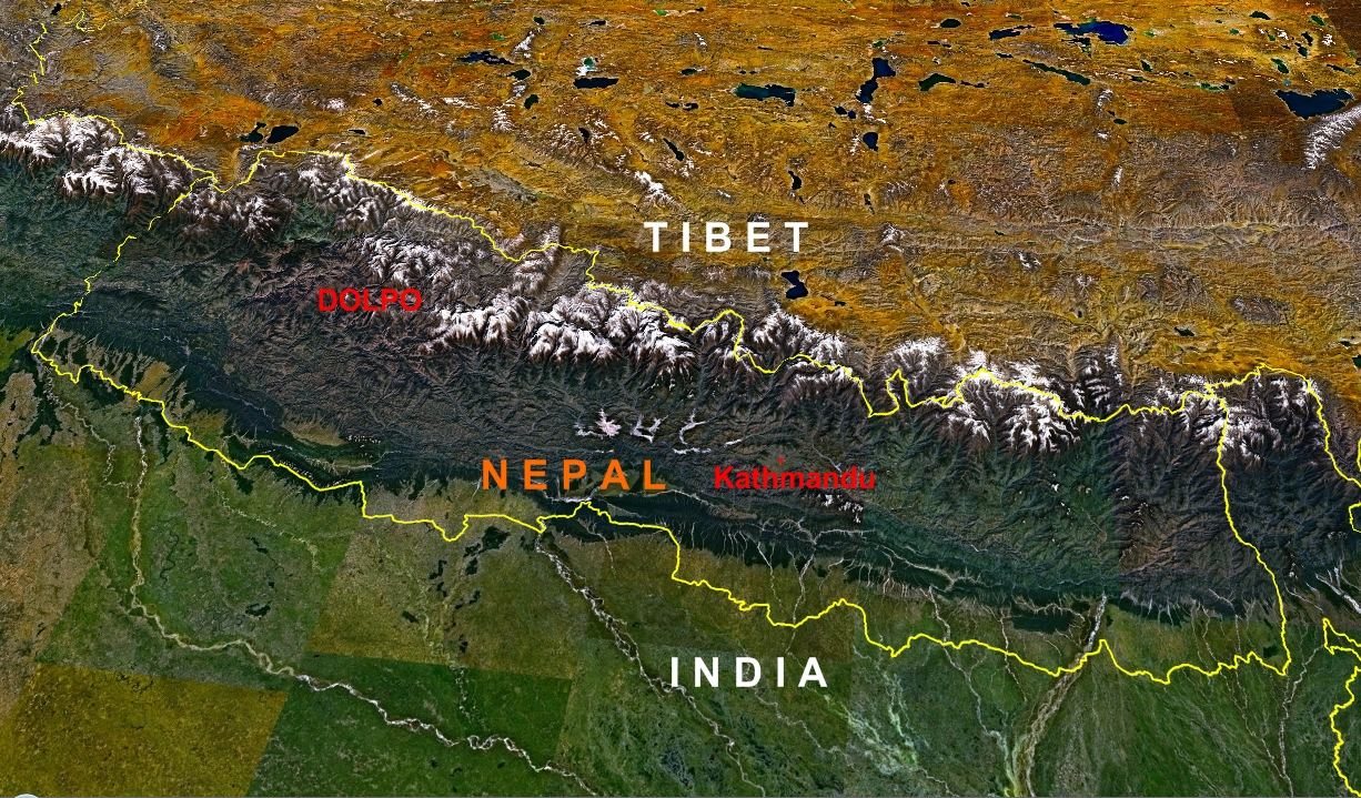
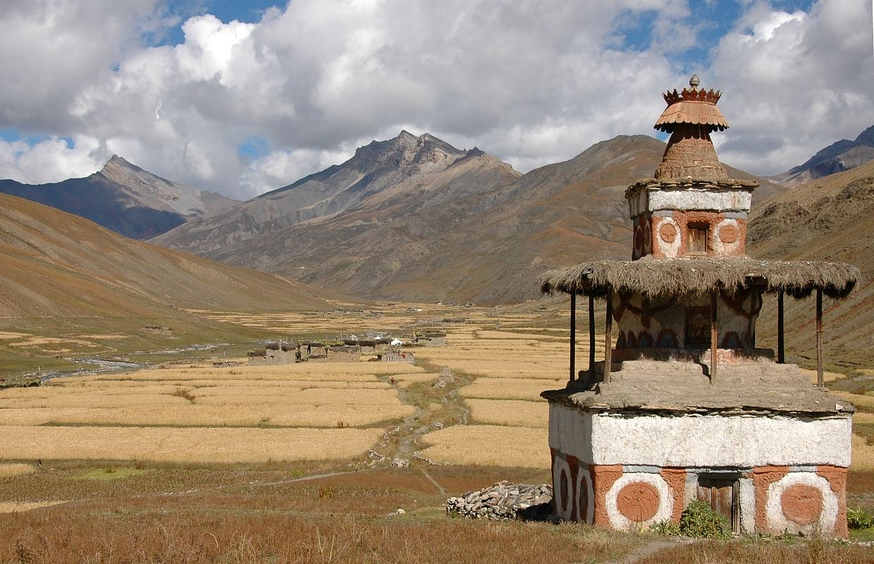
In fact Jomsom isn’t actually in the Dolpo region but is in Mustang, but it’s close enough for our purposes and we enter Dolpo almost as soon as we leave Jomsom and start our trek the following day. Maybe from the photo below you can see why I suggested a similarity to ‘the frontier’? On the bright side there are a number of shops selling the items trekkers normally would want from chocolate bars to trekking poles. All hotels have attached restaurants with comprehensive menus and as the food tends to subsidise the room cost we will need to eat where we are staying or they will increase the room rate! I’m sure it will be fine, especially as it will be our last sleep in a bed for nearly 3 weeks.

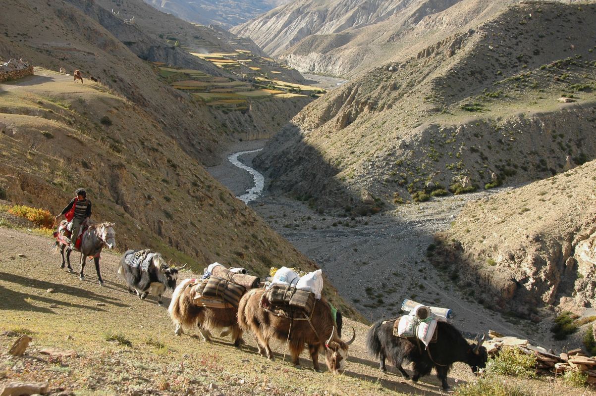
Thu 4 Nov. Provided everyone is feeling good and our support sherpas arrived safely by road we will ship out on the trek. We will head north out of Jomsom following the Kali Gandaki River valley towards Kagbeni. I mentioned a number of route uncertainties in my blog on Monday and the first appears immediately. At this stage we don’t yet know whether we shall stop the first night around Kagbeni after a relatively short and easy day to allow a little extra time for acclimatisation before heading to the mountains, or whether we should head straight up. The current plan is the latter and I shall work on that basis in my next blog which will cover the first 5 days on the trek itself.

The outline trek route

10 Monday Oct 2016

Posted by andyjameswriter in Dolpo trek

≈ 4 Comments

The excitement is building. With 3 weeks to go until I leave for Kathmandu on the evening of Monday 31st October I thought you might be interested to know the route we plan to take on the trek. There are still some details to sort out, caused mainly by the lack of agreement between various mapping sources on the naming of the some of the villages we plan to visit, but the core is agreed.

The pictures below show where the Dolpo region is in Nepal as a whole and where it is in comparison with Kathmandu and other significant places and the countries to the north and south of Nepal. As can be seen, Dolpo is in the northwest part of Nepal, on the border with China (Tibet).

Dolpa district location.png      Nepal Location Map.jpg

We shall trek from Jomsom in the east to Jumla in the west staying fairly close to the northern border. We plan to depart Jomsom on Friday 4th November and are targeting arrival at Jumla 20 days later on Sun 24th. I calculate the distance as roughly 240 miles meaning we need to average 12 miles a day. In reality some days will be shorter, especially in the first few days as we acclimatise while also seeking to cross our first two 5000m+ (over 16,404ft) passes on day 4. These are the huge Jungben La at 5550m (18,209ft) and the only slightly lower Niwas La at 5120m (16,798ft). ‘La’ means ‘pass’ in Nepali. Given that we shall also need a few rest days to recover from the inevitable strains and injuries, the average distance trekked per day will need to be more than 12 miles. That’s quite a distance with height to gain and, ironically but logistically necessary, the toughest days are in the first week out of Jomsom.

Should it all prove a challenge too far there are options to cut the trek short via an ‘escape’ route. These opportunities arise at about the half-way point. Firstly after around 110 miles at Saldang and again 15 miles later at Bhijer. From both of these villages we can take a route south via Lake Phoksundo to the airports at Dunai, the administrative capital of the Dolpo, or nearby Juphal thus reducing the total distance trekked from 240 miles to around 170. These distances are yet to be verified but are in the right ballpark. I should mention that the distances are calculated based upon the sum of the straight line waypoint-to-waypoint distances, plus 25% to take account of the fact that we won’t be going in straight lines. Using Google Earth in conjunction with the best mapping I can get, from Jomsom to Jumla I have placed 421 waypoints. The total straight line distance from waypoint D421 (Jomsom airfield) to D001 (Jumla airfield) is 192 miles. Adding 25% leads to an estimated total distance of 240 miles. 25% may prove to be too much or too little. We won’t know until we do it and track the distance by GPS (hopefully).

Over the next few blogs I will go into more detail of the places we will visit or pass each day, where we plan to camp at night and the type of terrain we expect to be on. The next instalment will cover getting to Jomsom and the first day or two of the trek. In the meantime I hope the 2 pictures below give an indication of the general direction and key places.

The first is a screenshot of the route against a background of Google Earth in a 3D perspective slant from an imaginary spacecraft 75 miles above the earth. This shows every waypoint planned. The main route waypoint numbers are prefixed ‘D’ while the escape waypoints are prefixed ‘E’. Waypoints of significance have a name associated with the number. Unfortunately the size of the waypoints and their labels obscure much of the interesting satellite photo view but I will show this in smaller sections in a later blog. The point is that you can see the general lay of the land and our route across it.

The second is cleaner, showing the route as presented by Garmin’s BaseCamp application drawing mapping and route data from my GPS. In this view, which shows only the main route without the escape and the mapping relevant to the trek, every waypoint is shown as a black dot without it’s label, on a ribbon of pink. The principal places I mentioned earlier are labeled. The purple line to the top right of the picture is the border with China (Tibet).

The people of the Dolpo – the Dolpapa

07 Friday Oct 2016

Posted by andyjameswriter in Dolpo trek

≈ 3 Comments

Typically around 4000m high but surrounded by mountains over 6000m the Dolpo is inhabited by the toughest of people, the Dolpapa. The ending comes from the Tibetan, pa, meaning people.

The Dolpapa speak Nepali, Dolpo, which is a local dialect of Tibetan, and Kaike, a minority language spoken in just one Dolpo valley.They grow most of the crops they need and keep yaks, sheep and goats. Dolpo is not heavily populated. There are but 30 or so rough stone-built Dolpapa villages in an area of 1300 square kilometres.

Most Dolpapa are Buddhist although the Bon religion of Tibet, which pre-dates Buddhism, is still practised in some villages. The numerous fortified monasteries known as gompas, the frequent chortens (Buddhist shrines) and the animistic wooden dolls placed on buildings to ward off evil spirits serve as a reminder of the Dolpapas’ spirituality.

Lack of contact with the outside world has left the Dolpapas traditional culture and lifestyle largely untouched, but this also means modern development has bypassed the Dolpo and poverty is widespread, at least by Western standards. This adds another dimension to the areas rugged beauty. This is a hard place to live and Dolpapa have had to become self-sufficient and resilient.

The major occupation is agriculture and most households grow potatoes, maize, wheat, millet, buckwheat, Tibetan barley, high altitude rice and native crops such as chino and kagumo. However lack of water and arable land is a problem and many can’t grow enough to feed themselves for the whole year. As a result animal husbandry is an important too with the number of animals owned indicating a family’s wealth and status. Sheep, goats, cattle and yaks are taken up to the high pastures for grazing during the summer months and brought back to the villages for the winter. Usually younger members of the family accompany the herds, living in stone huts. Yaks are well adapted to survival in this harsh environment. Indeed they can only live above 3000m. With their thick bushy tails and heavy wool and hair coats they can live outdoors in temperatures well below freezing. Their hair is woven into blankets and clothing, their skin provides leather and their milk forms an important part of the high altitude diet, both as liquid and as a hard dried cheese. In this barren region dried yak dung replaces wood as fuel for cooking and warmth and walls are often seen adorned with drying yak dung.

Trading is also important, particularly for those in the more remote areas. There are no roads in Dolpo so yaks are used as pack animals. Caravans of yaks go up to the high northern areas and across the border into Tibet or other Nepali mountain areas to collect medicinal plants, salt and other mineral resources, which are exchanged in lower areas for food, grains and other essentials. Finally, the weather is a tremendous challenge. In winter, when conditions in the high mountain areas are too harsh and cold for human survival, many people from the high villages leave their homes and live in yak hair tents in the lowland meadows, typically around the district headquarters of Dunai, where they survive by trading.

But the future may be looking a little better. Yarsagumba, which translates as ‘summer grass, winter insect’ is the mummified body of a Himalayan bat moth caterpillar that has been infected by a fungus. Found in Himalayan alpine areas at around 4000m Yarsagumba is prized for its supposed aphrodisiac properties when dried and eaten mixed with milk or honey. It fetches up to £650 per kilogram in China where it is also believed it to be a medicinal panacea, curing everything from headaches to cancer. Hardly surprising then that increasing numbers of Dolpapa head to the mountains in late spring in search of this fungal good fortune.

Perhaps more sustainable than yarsagumba, a tourism-training project has been underway in the district since 2008 with the aim of developing a number of new skills among the Dolpapa, including conversational English, cooking and hotel management.

This photograph from Wikipedia shows Dolpapa at a meeting outside of their village.

Not all Dolpapa are struggling farmers. Tenzin Norbu Lama was born in 1971 into a line of painters dating back more than 400 years. He began painting and training from a very young age and while he also trained in sculpture and mask making, painting and drawing were his favourites.painting and drawing were his favourites.

tennor.jpg

Known for its harsh climate his village lies at 4,500m and its dramatic mountain landscapes feature often in his art. Norbu says that for inspiration he draws on his family, historical books, legends, and his own memories of Dolpo, which he often sees in his dreams.

Norbu’s work has appeared in many international publications, including National Geographic magazine as well as the feature film, “Himalaya”, which was nominated for an Academy Award in 1999. Norbu exhibits his painting regularly in Nepal and abroad.

Here are some examples of his work.

TenzinNorbu_Caravan.jpg

3b99421a059af490381c37d0aa64fb18.jpg

Tenzing.Norbu.Himalayan.art.contemporain.contemporary.1-2.jpg

Why the Dolpo?

03 Monday Oct 2016

Posted by andyjameswriter in Dolpo trek

≈ 2 Comments

Over the past few months a common question in the minds of those I have told about this adventure is ‘so why the Dolpo?’. Following the brief introduction in my last post I offer a little more today. My sources are ‘The Great Himalayan Trail’, a book by Robin Boustead who developed the idea for the most challenging alpine trek in the world, and Wikipedia.

In his book, Robin says Dolpo is remote and wild, considered by many to be one of the most magical and mysterious of places in the Himalaya. Linked for hundreds of years to Tibet, this region lies among the high peaks, on top of the roof of the world. Oasis-like villages dot barren landscapes, scarred by deep canyons, and all beneath velvet blue skies. He goes on to say that a combination of ancient animist beliefs, Tibetan Buddhism, and Bon religions predominate throughout the cultivated Lower Dolpo valleys, and up to the high, arid plateau around Saldang. Now that Mustang is losing some off its authenticity following a new road having been built, the Dolpo is perhaps the the last genuine example of traditional Tibetan culture. This picture shows the location of Dolpo to the northwest of Nepal.

To add spice, should that be needed, Robin adds there are a number of trekking options that run through Dolpo and all are magnificent. Most trekkers enter and exit Dolpo via the dirt airstrip at Juphal in Lower Dolpo. Alternatively experienced groups could consider the much more committing access routes from Mustang (east) or Mugu (west) where trail finding and acclimatisation pose additional challenges.

You probably won’t be surprised to learn that we intend intend to trek around 240 miles from Jomsom in Mustang to Jumla in the west. Most of the time we shall be over 4000m with frequent climbs to over 5000m and camping every night. I have seen treks offered from Jomsom to Juphal (or the other way) and from Jumla to Juphal (or the other way) but not all the way from Jomsom to Jumla. We shall be using Juphal as our emergency exit should that be necessary.

I hope this answers the question ‘why Dolpo?’. It is quite simply a breathtaking challenge – in more ways than one!

I will share the detailed main trekking route and the emergency exit route in due course but will close now with a few photos from wikipedia that hopefully bring the text to life. I expect to bring a few photos back that I can share without breaking copyright. Should you want to see more photos in advance then an internet search for ‘Dolpo photos’ might be rewarding!

These are Lower Dolpo from wikipedia. Upper Dolpo is more mountainous.

Introducing the Dolpo adventure

01 Saturday Oct 2016

Posted by andyjameswriter in Dolpo trek

≈ 8 Comments

One month from today, at about this time on Tuesday 1st November, I will be landing in Kathmandu at the start of an incredible adventure the seeds of which were sown 3 years ago. In early October 2013 I and others were at the bar in Kathmandu’s Everest Hotel having just returned from Cho Oyu. The expedition leader, now my good friend, Tim Calder was telling us about his dream trek. While he had travelled extensively throughout Nepal he was drawn to the Dolpo region. Dolpo is described by the trekking company KE Adventure Travel as “one of the least accessible and yet most alluring corners of Nepal. Few travellers have penetrated to the heart of Dolpo. This is very much the land that time forgot.” Kamzang Journeys says that Dolpo is “one of the highest inhabited realms on the planet; a breathtakingly beautiful and mountainous region of fortified villages, ‘dzongs’, turquoise lakes, sacred mountains and high passes.”

Tim’s dream was to complete an extensive trek of over 200 miles through this region along the Great Himalayan Trail, climbing many 5000+ metre passes and using ponies to assist with the load carrying. In the aftermath of the Cho Oyu expedition I was captivated by this dream but at that time never imagined it would become a reality. But through determination and with the support of many people, it now has.

Tim and I planned to make an attempt last year but in the wake of Nepalese earthquakes and with the relief effort still being in full swing we felt that a super-challenging trek could place an unreasonable burden on people still striving to recover. This year we see no such issues. The flights are booked and we will be in Nepal for the whole of November.

Over the next month I will share with you, periodically through my blog, information about the region and its people, our route, kit, communications and power, weather, insurance, planning and preparation and other bits and pieces that might be of interest. We will travel with a small team of fellow trekkers and sherpa support. Once on the trek I hope to be able to send updates by short email or text from a satellite phone either directly to the blog or via Clare who has offered once again to be “Radar” (the radio operator from M*A*S*H).

While KE, Kamzang and other trekking companies do offer trekking in Dolpo, Tim and I don’t think anyone has walked as extensively over such tough terrain within our timeframe as we plan to. We don’t even know if it can be done.

Excited? Oh yes!

Watch this space…

Newer posts →

Enter your email address to subscribe to this blog and receive notifications of new posts by email.

Join 49 other subscribers
Follow Andy James on WordPress.com

Blog Archive Categories

  • Dolpo trek (45)
  • Lefkas (3)
  • Mont Blanc June 2019 (9)
  • Picos de Europa (8)
  • The Great Glen Way (5)
  • The Haute Route (10)
  • The West Highland Way (6)
  • The Writing Journal (6)
  • Walking London – the Capital Ring (4)

Blog at WordPress.com.

  • Subscribe Subscribed
    • Andy James
    • Join 49 other subscribers
    • Already have a WordPress.com account? Log in now.
    • Andy James
    • Subscribe Subscribed
    • Sign up
    • Log in
    • Report this content
    • View site in Reader
    • Manage subscriptions
    • Collapse this bar
 

Loading Comments...